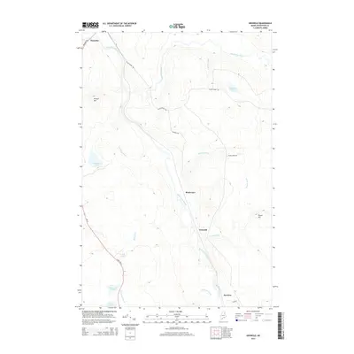
2014 Map of Griswold
USGS Topo · Published 2014About this map
Saint Croix Stream flows through the heart of this Aroostook County landscape, serving as a central geographic corridor between the small settlements of Griswold and Blackwater. The terrain is defined by low-lying wetlands and scattered upland peaks like Pollard Mtn and Picard Hill, with numerous small bodies of water such as Cranberry Pond, Hall Pond, and Matherson Pond dotting the map. This 2014 survey captures the region's character as a managed timber and recreational landscape, where a network of gravel roads including Black Water Rd and Griswald Rd provides access to remote interior points. In the northwest corner, the community of Masardis sits near the junction of Masardis Rd, while State Hwy 11 cuts through the southwest, marking the primary transit route through this part of the Maine woods. The map highlights a quiet interior economy based on the seasonal flow of the streams and the accessibility of its brooks and ponds.
Find a feature on this map
24 named features on this map. Tap any name to fly to it.
Don’t see what you’re looking for? This feature index may not catch every label — zoom into the map to look around manually.
Map Details
Editions of this 2014 Griswold Map
This is the sole edition of this map. No revisions or reprints were ever made.
Other maps of this area

1931 · Ashland
USGS Topo · 1:48,000

1934 · Ashland
USGS Topo · 1:62,500

1935 · Howe Brook
USGS Topo · 1:48,000

1935 · Presque Isle
USGS Topo · 1:62,500

1939 · Howe Brook
USGS Topo · 1:62,500

1940 · Oxbow
USGS Topo · 1:62,500

1942 · Oxbow
USGS Topo · 1:62,500

1953 · Ashland
USGS Topo · 1:62,500

1953 · Presque Isle
USGS Topo · 1:62,500

1954 · Howe Brook
USGS Topo · 1:62,500