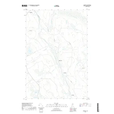
2018 Map of Griswold
USGS Topo · Published 2018About this map
Saint Croix Stream anchors this remote northern landscape, winding past the settlements of Masardis, Griswold, and Blackwater in central Aroostook County. The terrain is defined by a dense network of waterways and wetlands, including Cranberry Pond, Hall Pond, and Otter Pond, which serve as natural landmarks amidst the low-lying timberlands. The local infrastructure is oriented toward the river valleys, with Black Water Rd and Griswold Rd tracing the paths of the Blackwater River and its tributaries. To the west, the elevation rises toward Pollard Mtn, while Picard Hill stands to the east, providing topographical relief to the marshy plains. This 2018 survey reveals a territory where modern roadways such as Co Rd 12 and Co Rd 15 follow historic settlement patterns, maintaining connectivity between isolated outposts like Hawkins and the surrounding wilderness.
Find a feature on this map
22 named features on this map. Tap any name to fly to it.
Don’t see what you’re looking for? This feature index may not catch every label — zoom into the map to look around manually.
Map Details
Editions of this 2018 Griswold Map
This is the sole edition of this map. No revisions or reprints were ever made.
Other maps of this area

1931 · Ashland
USGS Topo · 1:48,000

1934 · Ashland
USGS Topo · 1:62,500

1935 · Howe Brook
USGS Topo · 1:48,000

1935 · Presque Isle
USGS Topo · 1:62,500

1939 · Howe Brook
USGS Topo · 1:62,500

1940 · Oxbow
USGS Topo · 1:62,500

1942 · Oxbow
USGS Topo · 1:62,500

1953 · Ashland
USGS Topo · 1:62,500

1953 · Presque Isle
USGS Topo · 1:62,500

1954 · Howe Brook
USGS Topo · 1:62,500