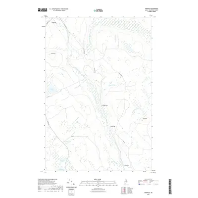
2021 Map of Griswold
USGS Topo · Published 2021About this map
Saint Croix Stream and the Blackwater River dominate this Aroostook County landscape, where the northern Maine woods meet established rural settlements. The area around Masardis serves as the primary hub, with local routes like Black Water Rd and Griswold Rd connecting the smaller locales of Blackwater and Griswold. The terrain is characterized by significant wetlands and water bodies, including Cranberry Pond, Hall Pond, and Matherson Pond, alongside the prominent heights of Pollard Mtn and Picard Hill. The drainage patterns of Quinsy Brook, Meadow Brook, and Matherson Brook reveal a complex network of waterways that have historically shaped the navigation and land use of this interior timber region, providing a detailed look at the geographical layout of these remote communities in the 21st century.
Find a feature on this map
23 named features on this map. Tap any name to fly to it.
Don’t see what you’re looking for? This feature index may not catch every label — zoom into the map to look around manually.
Map Details
Editions of this 2021 Griswold Map
This is the sole edition of this map. No revisions or reprints were ever made.
Other maps of this area

1931 · Ashland
USGS Topo · 1:48,000

1934 · Ashland
USGS Topo · 1:62,500

1935 · Howe Brook
USGS Topo · 1:48,000

1935 · Presque Isle
USGS Topo · 1:62,500

1939 · Howe Brook
USGS Topo · 1:62,500

1940 · Oxbow
USGS Topo · 1:62,500

1942 · Oxbow
USGS Topo · 1:62,500

1953 · Ashland
USGS Topo · 1:62,500

1953 · Presque Isle
USGS Topo · 1:62,500

1954 · Howe Brook
USGS Topo · 1:62,500