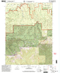
1998 Map of Grizzly Peak
USGS Topo · Published 2003About this map
Grizzly Peak stands as the prominent height in this mountain landscape, which straddles the Siskiyou Co Shasta Co boundary. The Pacific Crest National Scenic Trail winds through the southern terrain, connecting high-elevation landmarks like Pigeon Hill and the headwaters of numerous drainages. The McCloud River flows across the northern reaches, fed by a complex network of creeks including Whiskey Creek, Tate Creek, and Blue Heron Creek.
Find a feature on this map
32 named features on this map. Tap any name to fly to it.
Don’t see what you’re looking for? This feature index may not catch every label — zoom into the map to look around manually.
Map Details
Editions of this 1998 Grizzly Peak Map
This is the sole edition of this map. No revisions or reprints were ever made.
Other maps of this area

1886 · Modoc Lava Bed
USGS Topo · 1:250,000

1886 · Shasta
USGS Topo · 1:250,000

1892 · Modoc Lava-Bed
USGS Topo · 1:250,000

1894 · Shasta
USGS Topo · 1:250,000

1932 · Bartle
USGS Topo · 1:96,000

1935 · Dunsmuir
USGS Topo · 1:125,000

1939 · Bartle
USGS Topo · 1:125,000

1948 · Weed
USGS Topo · 1:250,000

1950 · Weed
USGS Topo · 1:250,000

1954 · Shoeinhorse Mountain
USGS Topo · 1:62,500