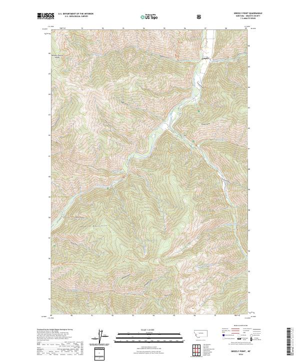
2024 Map of Grizzly Point
USGS Topo · Published 2024About this map
Quigley stands as a point of interest along the northeastern edge of this map, situated where Sawmill Creek meets the larger drainage. The landscape is defined by the steep drainages of the Sapphire Mountains, protected in part by the Welcome Creek Wilderness and the Lolo National Forest. The map details a complex system of ridges and gulches, including Bidwell Gulch and Waho Gulch, which feed into the central corridor of Rock Creek.
Find a feature on this map
44 named features on this map. Tap any name to fly to it.
Don’t see what you’re looking for? This feature index may not catch every label — zoom into the map to look around manually.
Map Details
Editions of this 2024 Grizzly Point Map
This is the sole edition of this map. No revisions or reprints were ever made.
Other maps of this area

1903 · Bonner
USGS Topo · 1:125,000

1909 · Sapphire
USGS Topo · 1:125,000

1947 · Butte
USGS Topo · 1:250,000

1958 · Butte
USGS Topo · 1:250,000

1959 · Cleveland Mountain
USGS Topo · 1:62,500

1959 · Ravenna
USGS Topo · 1:62,500

1960 · Butte
USGS Topo · 1:250,000

1962 · Butte
USGS Topo · 1:250,000
1974 · Sawmill Saddle
USGS Topo · 1:24,000
1975 · Alder Gulch
USGS Topo · 1:24,000