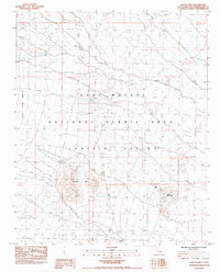
1984 Map of Grotto Hills
USGS Topo · Published 1984About this map
Lanfair Valley defines this high desert landscape, captured here during the mid-1980s when the region was designated as the East Mojave National Scenic Area. The map reveals a sparse but vital network of human activity in the arid environment, centered around the O X Ranch and the small settlement at Lanfair. A notable historical corridor, the Old Govt Road to Old Fort Mojave, traverses the southern portion of the sheet, tracing a path used by travelers long before modern infrastructure arrived.
Find a feature on this map
18 named features on this map. Tap any name to fly to it.
Don’t see what you’re looking for? This feature index may not catch every label — zoom into the map to look around manually.
Map Details
Editions of this 1984 Grotto Hills Map
This is the sole edition of this map. No revisions or reprints were ever made.
Other maps of this area

1910 · Ivanpah
USGS Topo · 1:250,000

1912 · Ivanpah
USGS Topo · 1:250,000

1942 · Ivanpah
USGS Topo · 1:250,000

1947 · Kingman
USGS Topo · 1:250,000

1948 · Kingman
USGS Topo · 1:250,000

1954 · Kingman
USGS Topo · 1:250,000

1955 · Kingman
USGS Topo · 1:250,000

1955 · Mid Hills
USGS Topo · 1:62,500
1956 · Lanfair Valley
USGS Topo · 1:62,500

1956 · Ivanpah
USGS Topo · 1:62,500