Loading...
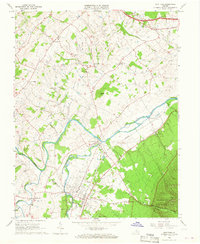
Loading map...1964 Map of Grottoes
USGS Topo · Published 1966About this map
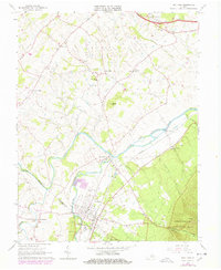
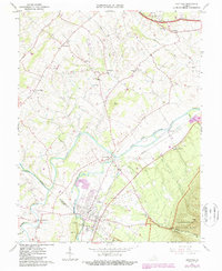
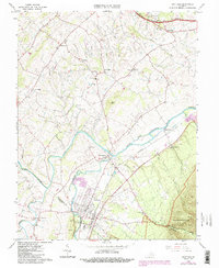
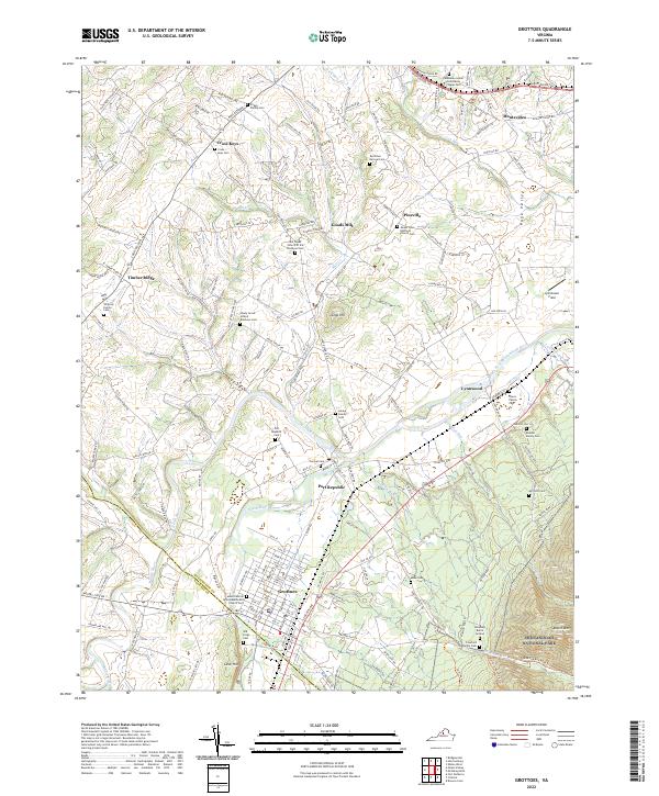
The confluence of the North Fork Shenandoah River and South Fork Shenandoah River anchors this mid-1960s survey of the Virginia landscape. Located at the boundary of Rockingham Co and Augusta Co, the town of Port Republic stands as a central historical point, marked by the Port Republic Battle Mon. To the north, the Cross Keys Battle Mon commemorates another Civil War engagement in an area of quiet farmsteads and rural churches like Mill Creek Ch.
Find a feature on this map
40 named features on this map. Tap any name to fly to it.
Don’t see what you’re looking for? This feature index may not catch every label — zoom into the map to look around manually.
Map Details
Date Portrayed1964
Date Published1966
PublisherU.S. Geological Survey
Map TypeTopographic
Scale1:24000
Physical Dimensions22.1 x 27 inches
Editions of this 1964 Grottoes Map
4 editions found
Historical Maps of Cross Keys Through Time
Featured Locations
Source Details
SourceU.S. Geological Survey
CopyrightPublic Domain