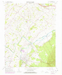
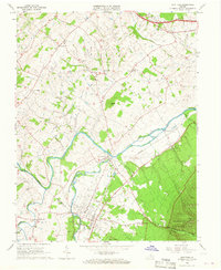
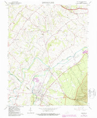
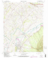
1964 Map of Grottoes
USGS Topo · Published 1978About this map
The confluence of the North Fork Shenandoah River and South Fork Shenandoah River anchors this mid-century portrait of the Shenandoah Valley, where agricultural hamlets and Civil War history intersect. The landscape is marked by commemorative landmarks including the Cross Keys Battle Mon and the Port Republic Battle Mon, reflecting the area's strategic significance during the 1862 Valley Campaign. Settled areas like Grottoes and Port Republic show a mix of residential growth and industry, serviced by the Norfolk and Western railroad corridor. Near Cave Hill, the renowned Grand Caverns stands as a primary natural landmark alongside early industrial remnants like the Old Forge Cem. To the east, the terrain rises sharply toward Austin Mtn within the boundary of Shenandoah National Park, where the Madison Run drains the wooded slopes.
Find a feature on this map
47 named features on this map. Tap any name to fly to it.
Don’t see what you’re looking for? This feature index may not catch every label — zoom into the map to look around manually.
Map Details
Editions of this 1964 Grottoes Map
4 editions found
Other maps of this area

1892 · Harrisonburg
USGS Topo · 1:125,000

1931 · University
USGS Topo · 1:62,500

1934 · Waynesboro
USGS Topo · 1:48,000

1935 · University
USGS Topo · 1:62,500

1937 · Elkton
USGS Topo · 1:62,500

1939 · Waynesboro
USGS Topo · 1:62,500

1941 · Harrisonburg
USGS Topo · 1:62,500

1943 · Harrisonburg
USGS Topo · 1:62,500

1949 · Charlottesville
USGS Topo · 1:250,000

1956 · Charlottesville
USGS Topo · 1:250,000