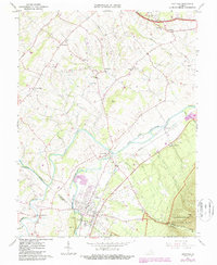
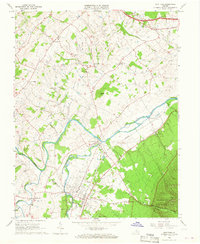
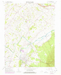
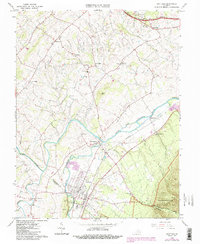
1964 Map of Grottoes
USGS Topo · Published 1987About this map
The convergence of the North Fork Shenandoah River and South Fork Shenandoah River anchors this mid-century survey of the Shenandoah Valley. Civil War history is prominently marked by the Cross Keys Battle Mon and the Port Republic Battle Mon, identifying the sites of 1862 engagements. The town of Grottoes is a central hub, notably home to the Grand Caverns near Cave Hill. To the west, Mt Meridian sits near the winding Middle River, while the Chesapeake and Western railroad tracks cut a diagonal path across the valley floor through Montevideo. The landscape transitions from the developed river bottoms to the steep slopes of Shenandoah National Park and Austin Mtn in the southeast, where the Madison Restricted Road and various trails penetrate the mountain forest.
Find a feature on this map
48 named features on this map. Tap any name to fly to it.
Don’t see what you’re looking for? This feature index may not catch every label — zoom into the map to look around manually.
Map Details
Editions of this 1964 Grottoes Map
4 editions found
Other maps of this area

1892 · Harrisonburg
USGS Topo · 1:125,000

1931 · University
USGS Topo · 1:62,500

1934 · Waynesboro
USGS Topo · 1:48,000

1935 · University
USGS Topo · 1:62,500

1937 · Elkton
USGS Topo · 1:62,500

1939 · Waynesboro
USGS Topo · 1:62,500

1941 · Harrisonburg
USGS Topo · 1:62,500

1943 · Harrisonburg
USGS Topo · 1:62,500

1949 · Charlottesville
USGS Topo · 1:250,000

1956 · Charlottesville
USGS Topo · 1:250,000