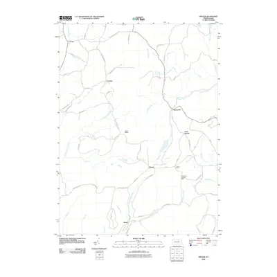
2010 Map of Grover
USGS Topo · Published 2010About this map
Grover and Chemung anchor the northern landscape of this region, where the terrain is defined by the significant rise of Ellenton Mountain. The area is characterized by a network of high-elevation plateaus and steep creek valleys, including the drainages of Towanda Creek and Schrader Creek. Small settlements and naming conventions like Maple Summit and Tompkins Corners suggest a history of upland farming and timbering. To the south, the village of Masten sits at the confluence of several mountain runs, including Pleasant Stream and Bear Run. A notable geographic landmark, Devils Elbow, marks a sharp turn in the topography between the highland ridges. The presence of the Tompkins Corners Vista indicates the significance of the overlook points in this part of Bradford and Lycoming counties, while various local roads such as the S&NY RD hint at the historical transport routes that once connected these isolated mountain communities.
Find a feature on this map
68 named features on this map. Tap any name to fly to it.
Don’t see what you’re looking for? This feature index may not catch every label — zoom into the map to look around manually.
Map Details
Editions of this 2010 Grover Map
This is the sole edition of this map. No revisions or reprints were ever made.
Other maps of this area

1927 · Eagles Mere
USGS Topo · 1:48,000

1930 · Warrensville
USGS Topo · 1:62,500

1932 · Eagle Mere
USGS Topo · 1:62,500

1934 · Warrensville
USGS Topo · 1:62,500

1942 · Canton
USGS Topo · 1:62,500

1943 · Powell
USGS Topo · 1:62,500

1944 · Canton
USGS Topo · 1:62,500

1945 · Powell
USGS Topo · 1:62,500

1953 · Warrensville
USGS Topo · 1:62,500

1953 · Eagles Mere
USGS Topo · 1:62,500
Featured Places
- Leroy Township, PA
- Grover, Canton Township
- Chemung, McNett Township
- Fox Township, PA
- Cascade Township, PA