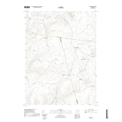
2019 Map of Grover
USGS Topo · Published 2019About this map
Grover and Ellenton anchor this 2019 survey of the high plateau country where Bradford Co, Lycoming Co, and Sullivan Co converge. The landscape is defined by the steep drainage of the Endless Mountains, where numerous runs and creeks like Towanda Cr, Schrader Cr, and Pleasant Stream carve deep into the terrain. Cultural markers like Rutty Cem and Ellenton Cem offer specific points of interest for genealogists tracing local families in these upland settlements.
Find a feature on this map
68 named features on this map. Tap any name to fly to it.
Don’t see what you’re looking for? This feature index may not catch every label — zoom into the map to look around manually.
Map Details
Editions of this 2019 Grover Map
This is the sole edition of this map. No revisions or reprints were ever made.
Other maps of this area

1927 · Eagles Mere
USGS Topo · 1:48,000

1930 · Warrensville
USGS Topo · 1:62,500

1932 · Eagle Mere
USGS Topo · 1:62,500

1934 · Warrensville
USGS Topo · 1:62,500

1942 · Canton
USGS Topo · 1:62,500

1943 · Powell
USGS Topo · 1:62,500

1944 · Canton
USGS Topo · 1:62,500

1945 · Powell
USGS Topo · 1:62,500

1953 · Warrensville
USGS Topo · 1:62,500

1953 · Eagles Mere
USGS Topo · 1:62,500
Featured Places
- Leroy Township, PA
- Grover, Canton Township
- Chemung, McNett Township
- Fox Township, PA
- Cascade Township, PA