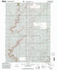
1997 Map of Grover NE
USGS Topo · Published 2000About this map
The Pawnee National Grassland dominates this high plains landscape of Weld County during the late twentieth century, characterized by its wide-open expanses and sparse human infrastructure. In the southeastern corner, the presence of the Zion Church and an adjacent Cemetery marks a quiet center for the local community near the winding Sidney Draw. This area reflects the functional requirements of cattle ranching and modern defense in the West, featuring several named landmarks like the Poston Windmill, Grassy Flat Windmill, and Big Hole Windmill. Perhaps most striking is the Missile Site located near the eastern boundary, a tangible reminder of the Cold War era's impact on these isolated northern Colorado plains. The map also details a network of technical sites including a Communication Tower and a Drill Hole, illustrating the region's role in telecommunications and resource exploration.
Find a feature on this map
14 named features on this map. Tap any name to fly to it.
Don’t see what you’re looking for? This feature index may not catch every label — zoom into the map to look around manually.
Map Details
Editions of this 1997 Grover NE Map
This is the sole edition of this map. No revisions or reprints were ever made.
Other maps of this area

1954 · Sterling
USGS Topo · 1:250,000

1954 · Scottsbluff
USGS Topo · 1:250,000

1954 · Cheyenne
USGS Topo · 1:250,000

1954 · Greeley
USGS Topo · 1:250,000

1957 · Greeley
USGS Topo · 1:250,000

1958 · Cheyenne
USGS Topo · 1:250,000

1958 · Greeley
USGS Topo · 1:250,000

1958 · Scottsbluff
USGS Topo · 1:250,000

1958 · Sterling
USGS Topo · 1:250,000

1961 · Greeley
USGS Topo · 1:250,000