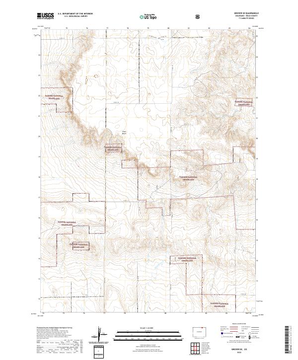
2022 Map of Grover SE
USGS Topo · Published 2022About this map
Pawnee National Grassland dominates this high plains landscape in Weld County, where the topography is defined by the sharp rise of the Chalk Bluffs and a network of ephemeral watercourses. This modern survey illustrates the expansive reach of the federal grassland, interspersed with sections of state and private lands. The drainage patterns of Sidney Draw and N Pawnee Cr reveal the natural hydrology of the shortgrass prairie, while seasonal flows like Wild Horse Cr and Igo Cr carve subtle valleys through the arid terrain.
Find a feature on this map
22 named features on this map. Tap any name to fly to it.
Don’t see what you’re looking for? This feature index may not catch every label — zoom into the map to look around manually.
Map Details
Editions of this 2022 Grover SE Map
This is the sole edition of this map. No revisions or reprints were ever made.
Other maps of this area

1954 · Sterling
USGS Topo · 1:250,000

1954 · Greeley
USGS Topo · 1:250,000

1957 · Greeley
USGS Topo · 1:250,000

1958 · Greeley
USGS Topo · 1:250,000

1958 · Sterling
USGS Topo · 1:250,000

1961 · Greeley
USGS Topo · 1:250,000

1964 · Greeley
USGS Topo · 1:250,000

1965 · Greeley
USGS Topo · 1:250,000
1972 · Grover North
USGS Topo · 1:24,000

1972 · Keota NW
USGS Topo · 1:24,000