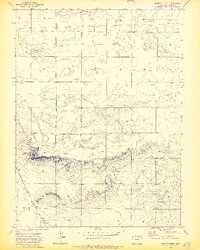
1972 Map of Grover North
USGS Topo · Published 1974About this map
The high plains of Weld County meet a dramatic escarpment in this early 1970s survey. The landscape is defined by the small settlement of Grover in the southwestern corner, adjacent to the Burlington Northern railroad line which cuts through the southern terrain. This area reflects a reliance on the land's subterranean resources, evidenced by several Oil Wells and a Gravel Pit scattered across the northern sections.
Find a feature on this map
7 named features on this map. Tap any name to fly to it.
Don’t see what you’re looking for? This feature index may not catch every label — zoom into the map to look around manually.
Map Details
Editions of this 1972 Grover North Map
2 editions found
Other maps of this area

1954 · Cheyenne
USGS Topo · 1:250,000

1954 · Greeley
USGS Topo · 1:250,000

1957 · Greeley
USGS Topo · 1:250,000

1958 · Cheyenne
USGS Topo · 1:250,000

1958 · Greeley
USGS Topo · 1:250,000

1961 · Greeley
USGS Topo · 1:250,000

1963 · Pine Bluffs SE
USGS Topo · 1:24,000

1963 · Carpenter
USGS Topo · 1:24,000

1963 · Pine Bluffs SW
USGS Topo · 1:24,000

1964 · Greeley
USGS Topo · 1:250,000