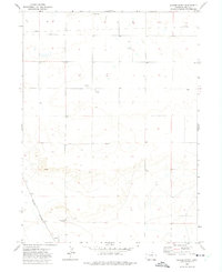
1972 Map of Grover North
USGS Topo · Published 1975About this map
The high plains of Weld County are captured here in the early 1970s, focused on the small agricultural and rail community of Grover. The landscape is defined by its industrial and infrastructure developments, featuring a significant Pipeline crossing the northern sectors and scattered Oil Well and Well sites that indicate the region's energy resources. The Burlington Northern railroad serves as a primary transit corridor, cutting through the southwestern portion of the map near the town center. For those tracing local history or family roots, the Home of Peace Cemetery is a prominent landmark located south of the main settlement. The terrain also shows evidence of local material extraction, such as the Gravel Pit near the northern boundary, illustrating a functional working landscape of the era.
Find a feature on this map
8 named features on this map. Tap any name to fly to it.
Don’t see what you’re looking for? This feature index may not catch every label — zoom into the map to look around manually.
Map Details
Editions of this 1972 Grover North Map
2 editions found
Other maps of this area

1954 · Cheyenne
USGS Topo · 1:250,000

1954 · Greeley
USGS Topo · 1:250,000

1957 · Greeley
USGS Topo · 1:250,000

1958 · Cheyenne
USGS Topo · 1:250,000

1958 · Greeley
USGS Topo · 1:250,000

1961 · Greeley
USGS Topo · 1:250,000

1963 · Pine Bluffs SE
USGS Topo · 1:24,000

1963 · Carpenter
USGS Topo · 1:24,000

1963 · Pine Bluffs SW
USGS Topo · 1:24,000

1964 · Greeley
USGS Topo · 1:250,000