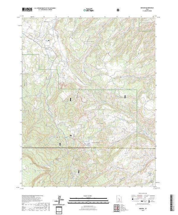
2023 Map of Grover
USGS Topo · Published 2023About this map
Grover sits at the northern edge of this high-altitude landscape where the foothills of Boulder Mtn meet the canyon country of Capitol Reef National Park. The settlement is marked by its small grid of streets including Center St and 810 W, with the nearby Grover Cem serving as a primary point of interest for local genealogy researchers. The terrain transitions dramatically from the high elevations of Chokecherry Point and The Terrace down into the carved drainages of Cuts Canyon and Sulphur Creek.
Find a feature on this map
45 named features on this map. Tap any name to fly to it.
Don’t see what you’re looking for? This feature index may not catch every label — zoom into the map to look around manually.
Map Details
Editions of this 2023 Grover Map
This is the sole edition of this map. No revisions or reprints were ever made.
Other maps of this area

1885 · Fish Lake
USGS Topo · 1:250,000

1896 · Fish Lake
USGS Topo · 1:250,000

1952 · Notom 3 SW
USGS Topo · 1:24,000

1952 · Notom 3 NW
USGS Topo · 1:24,000

1952 · Notom 2 SE
USGS Topo · 1:24,000

1952 · Notom 2 SW
USGS Topo · 1:24,000

1952 · Notom 4 NW
USGS Topo · 1:24,000

1952 · Notom 4 SW
USGS Topo · 1:24,000

1952 · Notom 3 SE
USGS Topo · 1:24,000

1952 · Notom 3 NE
USGS Topo · 1:24,000