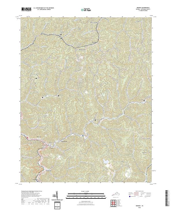
2022 Map of Grundy
USGS Topo · Published 2022About this map
Grundy and its adjacent communities of Poetown, Longbottom, and Royal City center this look at the mountain landscape of Southwest Virginia. The Levisa Fork winds through the valley, serving as a primary corridor for development while steep hollows like Mule Hollow and Stillhouse Hollow reach into the surrounding heights. In the town center, the Buchanan County Courthouse and the Appalachian School of Law stand as modern anchors within this traditionally coal-rich region. The map reveals a dense network of family history through numerous hillside cemeteries, including Shortridge and Belcher Cem, which are often accessed by winding routes like State Rte 659. Small settlements such as Roseann and Home Creek follow the creek beds, illustrating the traditional Appalachian pattern of settlement along narrow floodplains and mountain gaps.
Find a feature on this map
83 named features on this map. Tap any name to fly to it.
Don’t see what you’re looking for? This feature index may not catch every label — zoom into the map to look around manually.
Map Details
Editions of this 2022 Grundy Map
This is the sole edition of this map. No revisions or reprints were ever made.
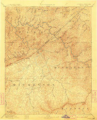
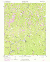
Historical Maps of Tookland Through Time
5 maps found