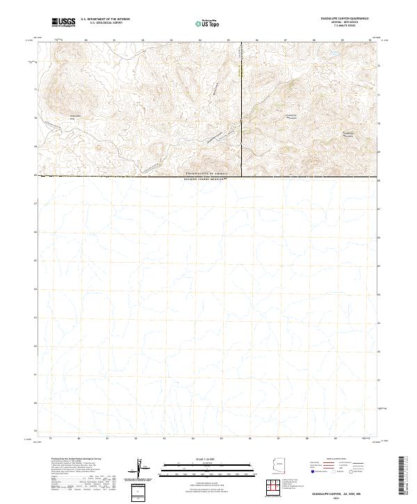
2021 Map of Guadalupe Canyon
USGS Topo · Published 2021About this map
The United States Of America Estados Unidos Mexicanos international boundary forms the lower portion of this quadrangle, where the arid high country of Cochise County, Arizona, meets the northern reaches of Sonora. The terrain is defined by the intersection of several significant geological formations, including the Pickhandle Hills and the southern extent of the Peloncillo Mountains. To the east, the Guadalupe Mountains rise sharply, creating a complex series of drainage patterns and high points. This remote corner of the American Southwest is traversed by Guadalupe Canyon Rd, which follows the natural passage of Guadalupe Canyon. Water sources are sparse in this landscape, though the Spring of Contention appears near the northern edge of the map, suggesting a site of historical importance in a region where water dictated survival and movement across the borderlands.
Find a feature on this map
13 named features on this map. Tap any name to fly to it.
Don’t see what you’re looking for? This feature index may not catch every label — zoom into the map to look around manually.
Map Details
Editions of this 2021 Guadalupe Canyon Map
This is the sole edition of this map. No revisions or reprints were ever made.
Other maps of this area

1918 · Cienega Springs
USGS Topo · 1:62,500

1919 · Perilla
USGS Topo · 1:125,000

1922 · McDonald
USGS Topo · 1:62,500

1955 · Douglas
USGS Topo · 1:250,000

1958 · Guadalupe Canyon
USGS Topo · 1:62,500

1959 · Douglas
USGS Topo · 1:250,000

1961 · Douglas
USGS Topo · 1:250,000

1964 · Douglas
USGS Topo · 1:250,000
1982 · Black Point
USGS Topo · 1:24,000
1983 · Alamo Hueco Mountains
USGS Topo · 1:100,000