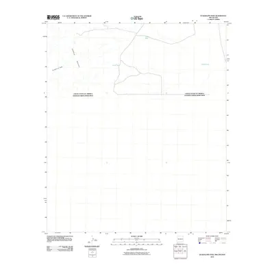
2010 Map of Guadalupe Pass
USGS Topo · Published 2010About this map
Guadalupe Pass serves as a critical topographic corridor within this arid borderland where the Guadalupe Mountains cross the international boundary. This 2010 survey emphasizes the transition between the United States and Mexico, documenting the remote ranching infrastructure that sustains life in the high desert. Scattered water sources such as Clark Tank, Corral Tank, and Garcia Tank are the primary landmarks in a landscape defined by seasonal drainages and rugged elevation changes. The map provides a precise look at the jurisdictional line separating the two nations, showing how the natural terrain of the mountains dictates the path of travel through the pass.
Find a feature on this map
6 named features on this map. Tap any name to fly to it.
Don’t see what you’re looking for? This feature index may not catch every label — zoom into the map to look around manually.
Map Details
Editions of this 2010 Guadalupe Pass Map
This is the sole edition of this map. No revisions or reprints were ever made.
Other maps of this area

1918 · Cienega Springs
USGS Topo · 1:62,500

1919 · Perilla
USGS Topo · 1:125,000

1922 · McDonald
USGS Topo · 1:62,500

1955 · Douglas
USGS Topo · 1:250,000

1958 · Guadalupe Canyon
USGS Topo · 1:62,500

1959 · Douglas
USGS Topo · 1:250,000

1961 · Douglas
USGS Topo · 1:250,000

1964 · Douglas
USGS Topo · 1:250,000
1982 · Fitzpatricks
USGS Topo · 1:24,000
1982 · Black Point
USGS Topo · 1:24,000