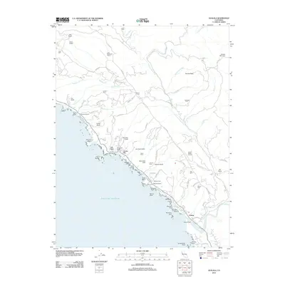
2012 Map of Gualala
USGS Topo · Published 2012About this map
Gualala and the rugged Mendocino coastline anchor this detailed 2012 survey, revealing a landscape defined by sharp coastal bluffs and narrow river canyons. The map tracks the winding course of the Garcia River and its south fork as they cut through the timbered heights of Gualala Mountain and Fleming Ridge. Along the Pacific shore, historic maritime sites like Bourns Landing, Collins Landing, and Steens Landing mark the area's history of coastal shipping, while the nearby Bourn Cem provides a specific point of interest for genealogists. The settlement at Anchor Bay and the specialized Lofty Redwoods Airport indicate the modern character of this stretch of Highway 1. Further inland, the map documents numerous family-named landmarks including Smith Ranch, Everson Ranch, and Johnson Ranch, illustrating the long-standing ranching and timber interests that have shaped the Mendocino coast.
Find a feature on this map
88 named features on this map. Tap any name to fly to it.
Don’t see what you’re looking for? This feature index may not catch every label — zoom into the map to look around manually.
Map Details
Editions of this 2012 Gualala Map
This is the sole edition of this map. No revisions or reprints were ever made.
Other maps of this area

1921 · Plantation
USGS Topo · 1:62,500

1943 · Point Arena
USGS Topo · 1:62,500

1943 · Stewarts Point
USGS Topo · 1:24,000

1943 · Ornbaun
USGS Topo · 1:62,500

1944 · Stewarts Point
USGS Topo · 1:31,680

1944 · Ornbaun
USGS Topo · 1:62,500

1947 · Santa Rosa
USGS Topo · 1:250,000

1949 · Santa Rosa
USGS Topo · 1:250,000

1958 · Santa Rosa
USGS Topo · 1:250,000

1960 · Saunders Reef
USGS Topo · 1:24,000