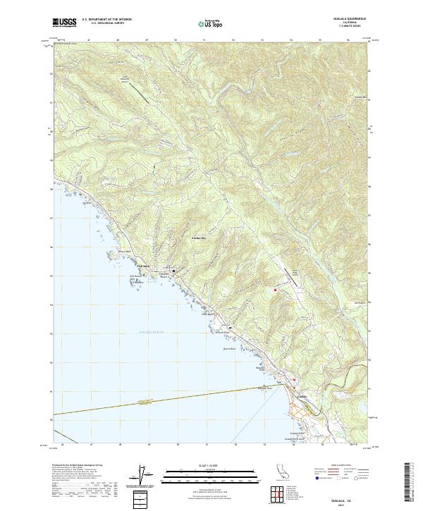
2021 Map of Gualala
USGS Topo · Published 2021About this map
Gualala and Anchor Bay anchor the jagged coastline of southern Mendocino County, where the coastal range meets the Pacific. The landscape is defined by deep drainages like Bourns Gulch and Getchell Gulch, while inland ridges such as Fleming Ridge rise toward Gualala Mtn. This era shows a community shaped by its topography, with small airstrips like Lofty Redwoods Airport and Ocean Ridge Airport providing aerial access to this complex terrain.
Find a feature on this map
86 named features on this map. Tap any name to fly to it.
Don’t see what you’re looking for? This feature index may not catch every label — zoom into the map to look around manually.
Map Details
Editions of this 2021 Gualala Map
This is the sole edition of this map. No revisions or reprints were ever made.
Other maps of this area

1921 · Plantation
USGS Topo · 1:62,500

1943 · Point Arena
USGS Topo · 1:62,500

1943 · Stewarts Point
USGS Topo · 1:24,000

1943 · Ornbaun
USGS Topo · 1:62,500

1944 · Stewarts Point
USGS Topo · 1:31,680

1944 · Ornbaun
USGS Topo · 1:62,500

1947 · Santa Rosa
USGS Topo · 1:250,000

1949 · Santa Rosa
USGS Topo · 1:250,000

1958 · Santa Rosa
USGS Topo · 1:250,000

1960 · Saunders Reef
USGS Topo · 1:24,000