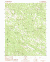
1991 Map of Gube Mountain
USGS Topo · Published 1991About this map
The high, ridged divide between Mendocino and Sonoma counties defines this 1991 survey, a landscape of isolated peaks and deep drainage networks. Human presence is concentrated around the small settlement of Billings in the northwest and Howlett Ranch near Horsethief Canyon, where the rugged topography has largely dictated the pattern of ranching and remote settlement.
Find a feature on this map
26 named features on this map. Tap any name to fly to it.
Don’t see what you’re looking for? This feature index may not catch every label — zoom into the map to look around manually.
Map Details
Editions of this 1991 Gube Mountain Map
This is the sole edition of this map. No revisions or reprints were ever made.
Other maps of this area

1921 · Skaggs
USGS Topo · 1:62,500

1921 · Plantation
USGS Topo · 1:62,500

1938 · Hopland
USGS Topo · 1:62,500

1943 · Tombs Creek
USGS Topo · 1:24,000

1943 · Stewarts Point
USGS Topo · 1:24,000

1943 · Annapolis
USGS Topo · 1:24,000

1943 · Hopland
USGS Topo · 1:62,500

1943 · Ornbaun
USGS Topo · 1:62,500

1944 · Annapolis
USGS Topo · 1:31,680

1944 · Stewarts Point
USGS Topo · 1:31,680