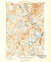
1933 Map of Guildhall
USGS Topo · Published 1933About this map
The Connecticut River serves as the central artery and state boundary in this 1930s survey, dictating the development of the Upper Connecticut River Valley. The landscape is defined by the proximity of the Grand Trunk and Maine Central railroads, which parallel the river and connect industrial hubs like Groveton and North Stratford. Evidence of the region’s timber and rural economy is visible at Browns Mill and numerous isolated farmstead-serving institutions such as Chessman Sch and Hayes Sch. While the river lowlands are dotted with settlements like Northumberland and Maidstone, the western terrain rises sharply into a dense network of peaks including Stone Mtn and West Mountain. This era shows the valley just as aerial photography began to refine topographic mapping, preserving the locations of remote homesteads and crossroads like Beatties and Masons before mid-century changes altered the local infrastructure.
Find a feature on this map
108 named features on this map. Tap any name to fly to it.
Don’t see what you’re looking for? This feature index may not catch every label — zoom into the map to look around manually.
Map Details
Editions of this 1933 Guildhall Map
3 editions found

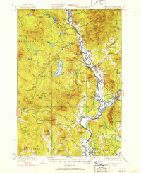
Other maps of this area

1893 · Mt. Washington
USGS Topo · 1:62,500

1896 · Mt. Washington
USGS Topo · 1:62,500

1900 · Whitefield
USGS Topo · 1:62,500

1920 · Guildhall
USGS Topo · 1:62,500

1924 · Island Pond
USGS Topo · 1:48,000

1926 · Island Pond
USGS Topo · 1:62,500

1929 · Averill
USGS Topo · 1:62,500

1930 · Percy
USGS Topo · 1:62,500

1930 · Dixville
USGS Topo · 1:62,500

1931 · Guildhall
USGS Topo · 1:48,000