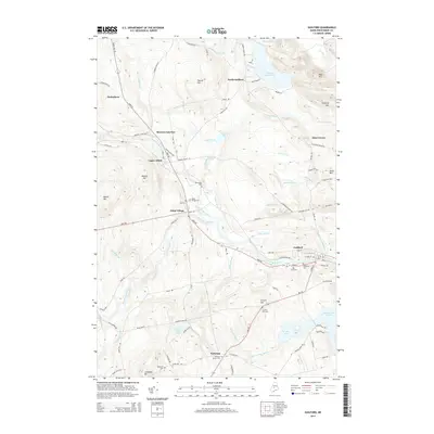
2014 Map of Guilford
USGS Topo · Published 2014About this map
The Piscataquis River valley serves as the primary corridor for settlement and transit in this region of Maine, anchoring the larger town of Guilford and the smaller community of Abbot Village. The landscape is a network of water and timbered heights, where Kingsbury Stream joins the river and numerous ponds like Harlow Pond and Second Davis Pond dot the lowlands. The presence of Monson Junction and segments of an Old Railroad Rd reflect the historic importance of rail transport for the local economy. Genealogists will find several burial sites preserved across the township, including Elmwood Cem, Lawn Cem, and the more remote Frenchs Hill Cem near French Hill. To the south, the village of Parkman sits at a crossroads, marked by the Parkman Corner Cem, while the northern hills rise toward peaks like Guilford Mtn and Oak Hill.
Find a feature on this map
99 named features on this map. Tap any name to fly to it.
Don’t see what you’re looking for? This feature index may not catch every label — zoom into the map to look around manually.
Map Details
Editions of this 2014 Guilford Map
This is the sole edition of this map. No revisions or reprints were ever made.
Other maps of this area

1933 · Guilford
USGS Topo · 1:62,500

1937 · Guilford
USGS Topo · 1:62,500

1948 · Kingsbury
USGS Topo · 1:62,500

1950 · Kingsbury
USGS Topo · 1:62,500

1950 · Sebec Lake
USGS Topo · 1:62,500

1951 · Greenville
USGS Topo · 1:62,500

1954 · Millinocket
USGS Topo · 1:250,000

1958 · Millinocket
USGS Topo · 1:250,000

1960 · Millinocket
USGS Topo · 1:250,000

1975 · Kingsbury NE
USGS Topo · 1:24,000