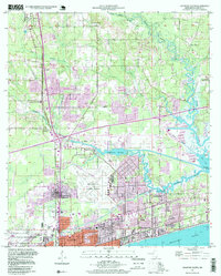
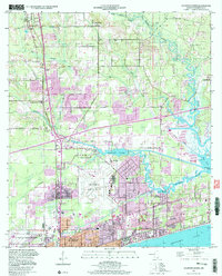
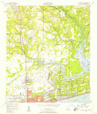
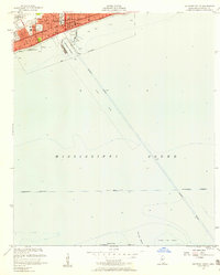
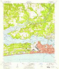
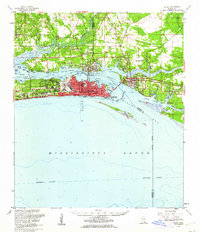
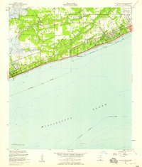
1994 Map of Gulfport North
USGS Topo · Published 1999About this map
Gulfport and its northern suburban reaches are mapped here in the mid-1990s, revealing a landscape defined by both rapid development and the intricate waterways of the Gulf Coast. The transition from the urban density of West Gulfport and Mississippi City to the more dispersed communities of Orange Grove and Lyman is punctuated by the meandering course of the Biloxi River and the Little Biloxi River. Substantial infrastructure supports the region, including the Gulfport-Biloxi Regional Airport and the U S Naval Reservation situated near the coastline of the Mississippi Sound.
Find a feature on this map
43 named features on this map. Tap any name to fly to it.
Don’t see what you’re looking for? This feature index may not catch every label — zoom into the map to look around manually.
Map Details
Editions of this 1994 Gulfport North Map
2 editions found
Other maps of this area

1953 · Mobile
USGS Topo · 1:250,000
1954 · Vestry
USGS Topo · 1:62,500
1954 · McHenry
USGS Topo · 1:62,500
1954 · Gulfport North
USGS Topo · 1:24,000
1954 · Gulfport South
USGS Topo · 1:24,000
1954 · Biloxi
USGS Topo · 1:24,000
1954 · Biloxi
USGS Topo · 1:62,500
1955 · Pass Christian
USGS Topo · 1:24,000
1956 · Gulfport NW
USGS Topo · 1:24,000

1957 · Mobile
USGS Topo · 1:250,000