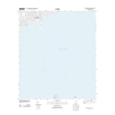
2012 Map of Gulfport South
USGS Topo · Published 2012About this map
Gulfport maritime infrastructure and coastal development dominate this 2012 survey of the Mississippi Sound. The map details the transition from the city's residential street grid to its industrial and recreational waterfront, featuring the Port of Gulfport and the adjacent Jones Memorial Park. As a primary commercial gateway for Harrison County, the area shows a complex arrangement of piers and shipping channels, including the Gulfport Harbor and the specialized Bert Jones Yacht Harbor. To the south, the map extends into the Gulf of Mexico, providing navigational context for Man of War Harbor and the sand features at North Point near Spade Fish Shoal. These underwater and shoreline features illustrate the maritime character of the Mississippi coast just years after significant post-storm redevelopment.
Find a feature on this map
49 named features on this map. Tap any name to fly to it.
Don’t see what you’re looking for? This feature index may not catch every label — zoom into the map to look around manually.
Map Details
Editions of this 2012 Gulfport South Map
This is the sole edition of this map. No revisions or reprints were ever made.
Other maps of this area

1893 · Cat Island
USGS Topo · 1:62,500

1946 · Isle Au Pitre
USGS Topo · 1:31,680

1950 · Ship Island
USGS Topo · 1:24,000

1951 · Cat Island
USGS Topo · 1:24,000

1953 · Mobile
USGS Topo · 1:250,000

1954 · Isle Au Pitre
USGS Topo · 1:31,680

1954 · Gulfport North
USGS Topo · 1:24,000

1954 · Gulfport South
USGS Topo · 1:24,000

1954 · Biloxi
USGS Topo · 1:24,000

1954 · Biloxi
USGS Topo · 1:62,500