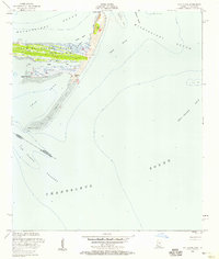
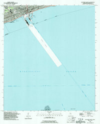
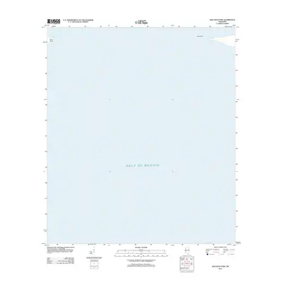
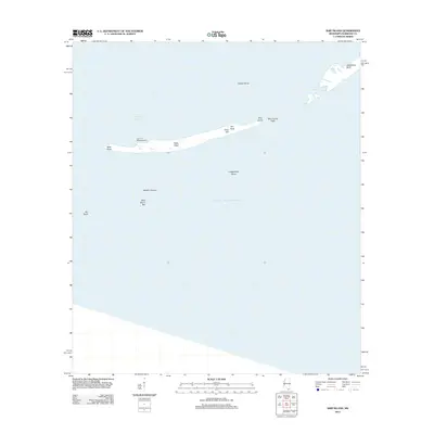
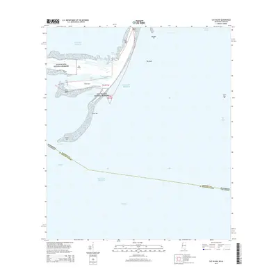
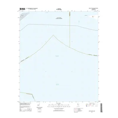
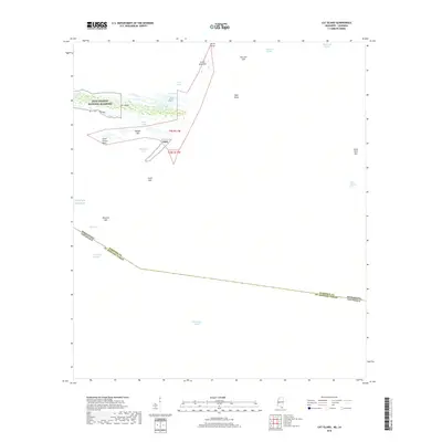
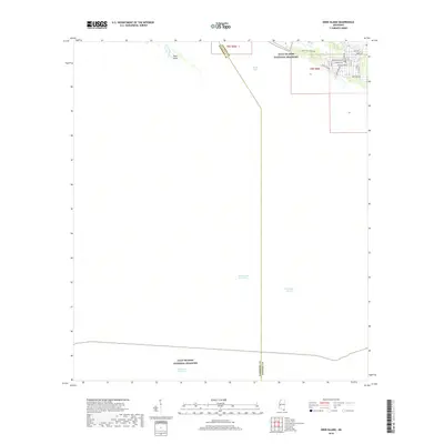
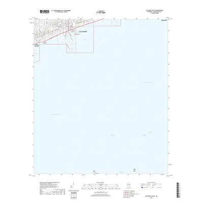
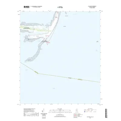
1951 Map of Cat Island
USGS Topo · Published 1958About this map
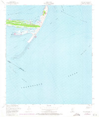
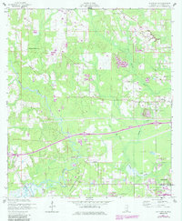
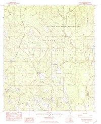
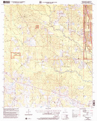
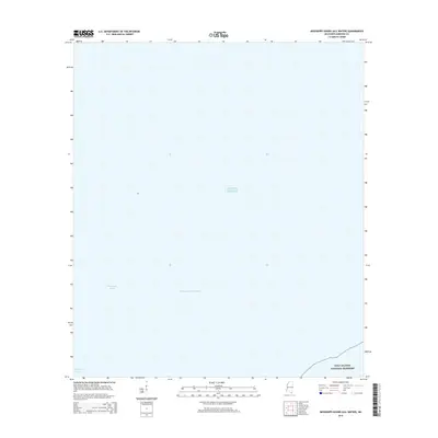
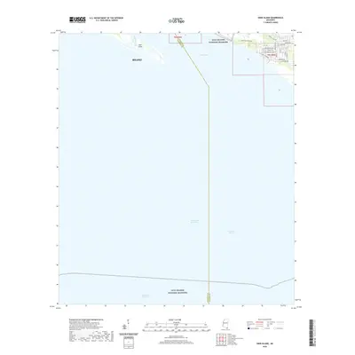
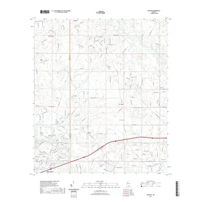
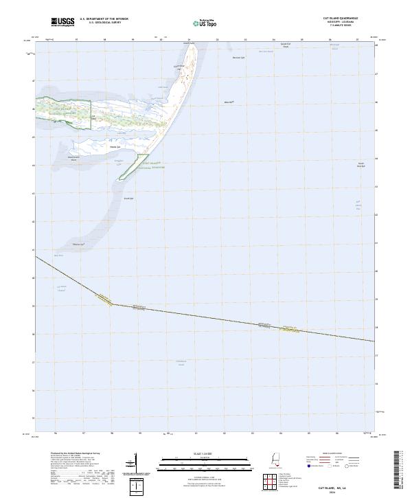
The Juan De Cuevas Claim dominates the landscape of Cat Island in this mid-century survey, reflecting the complex colonial and private land history of the Gulf Coast. The island's distinctive T-shape is defined by coastal features like North Point and the prominent Great Sand Hill, which rises above the surrounding marsh and timber. To the south, the terrain fragments into a series of elongated sand formations including Middle Spit, South Spit, and Phoenix Spit, illustrating the dynamic nature of the Mississippi Sound's barrier islands before later storms and erosion altered their profiles. Maritime researchers will find interest in the documented hydrography, from the Flowing Well on the eastern shore to the navigation hazards of Raccoon Swash and the West Bank. The map also captures the boundary between Harrison County and St. Bernard Parish, marking the intersection of Mississippi and Louisiana waters in the Chandeleur Channel.
Find a feature on this map
26 named features on this map. Tap any name to fly to it.
Don’t see what you’re looking for? This feature index may not catch every label — zoom into the map to look around manually.
Map Details
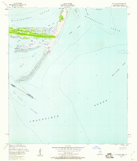
Editions of this 1951 Cat Island Map
3 editions found
Historical Maps of Harrison County Through Time
86 maps found
1950 Dog Keys Pass
Harrison County, MS
1950 Ship Island
Harrison County, MS
1951 Cat Island
Harrison County, MS

1954 Deer Island
Harrison County, MS
1954 Gulfport North
Harrison County, MS
1954 Gulfport South
Harrison County, MS
1954 McHenry
Harrison County, MS
1956 Gulfport NW
Harrison County, MS
1956 Vidalia
Harrison County, MS
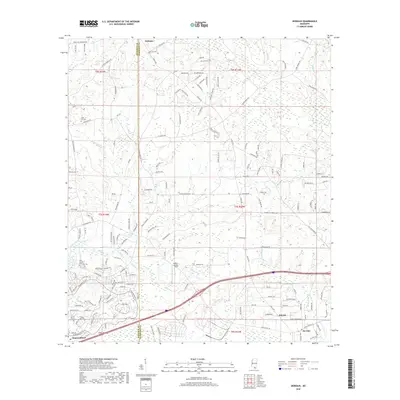
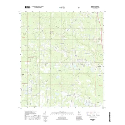
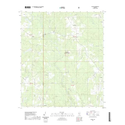
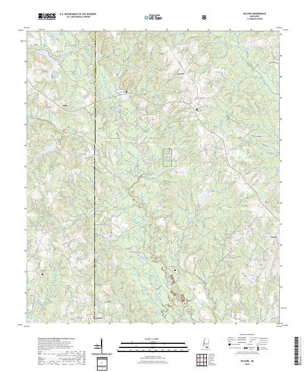
1982 Sellers
Harrison County, MS
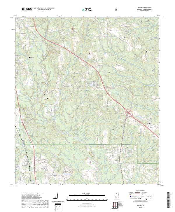
1982 Success
Harrison County, MS
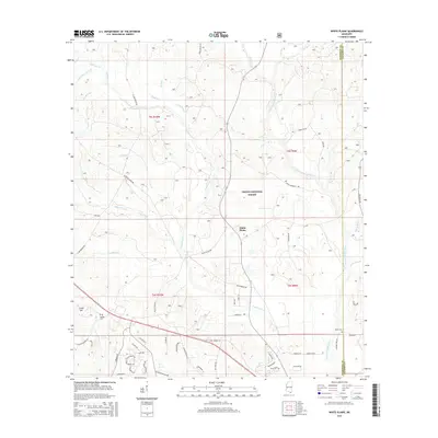
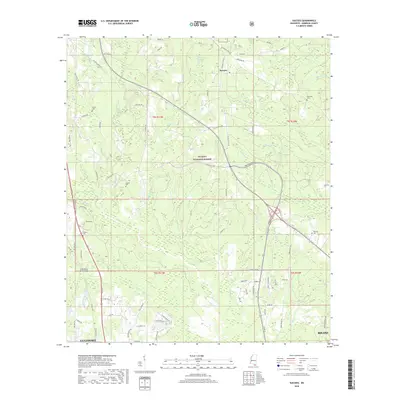
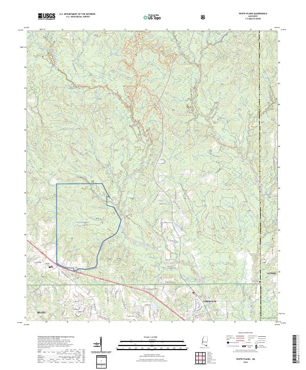
1982 White Plains
Harrison County, MS
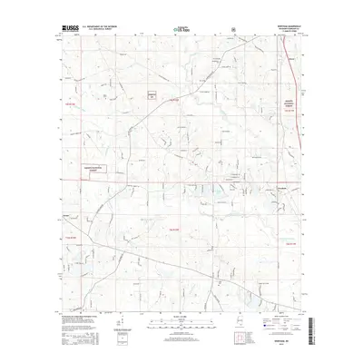
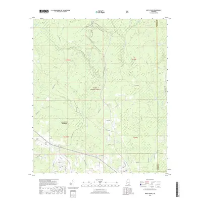
1983 Wortham
Harrison County, MS
1994 Cat Island
Harrison County, MS
1994 Gulfport North
Harrison County, MS
1994 Gulfport South
Harrison County, MS
1997 Dedeaux
Harrison County, MS
1997 Gulfport NW
Harrison County, MS
2000 Success
Harrison County, MS
2000 Wortham
Harrison County, MS
2012 Cat Island
Harrison County, MS
2012 Dedeaux
Harrison County, MS
2012 Deer Island
Harrison County, MS
2012 Dog Keys Pass
Harrison County, MS
2012 Gulfport North
Harrison County, MS
2012 Gulfport NW
Harrison County, MS
2012 Gulfport South
Harrison County, MS
2012 Sellers
Harrison County, MS
2012 Ship Island
Harrison County, MS
2012 Success
Harrison County, MS
2012 White Plains
Harrison County, MS
2012 Wortham
Harrison County, MS
2015 Cat Island
Harrison County, MS
2015 Dedeaux
Harrison County, MS
2015 Deer Island
Harrison County, MS
2015 Dog Keys Pass
Harrison County, MS
2015 Gulfport North
Harrison County, MS
2015 Gulfport NW
Harrison County, MS
2015 Gulfport South
Harrison County, MS
2015 Mississippi Sound (All Water)
Harrison County, MS
2015 Sellers
Harrison County, MS
2015 Ship Island
Harrison County, MS
2015 Success
Harrison County, MS
2015 White Plains
Harrison County, MS
2015 Wortham
Harrison County, MS
2018 Cat Island
Harrison County, MS
2018 Dedeaux
Harrison County, MS
2018 Deer Island
Harrison County, MS
2018 Dog Keys Pass
Harrison County, MS
2018 Gulfport North
Harrison County, MS
2018 Gulfport NW
Harrison County, MS
2018 Gulfport South
Harrison County, MS
2018 Mississippi Sound (All Water)
Harrison County, MS
2018 Sellers
Harrison County, MS
2018 Ship Island
Harrison County, MS
2018 Success
Harrison County, MS
2018 White Plains
Harrison County, MS
2018 Wortham
Harrison County, MS
2020 Cat Island
Harrison County, MS
2020 Deer Island
Harrison County, MS
2020 Dog Keys Pass
Harrison County, MS
2020 Mississippi Sound (All Water)
Harrison County, MS
2020 Ship Island
Harrison County, MS
2021 Dedeaux
Harrison County, MS
2021 Gulfport North
Harrison County, MS
2021 Gulfport NW
Harrison County, MS
2021 Gulfport South
Harrison County, MS
2021 Sellers
Harrison County, MS
2021 Success
Harrison County, MS
2021 White Plains
Harrison County, MS
2021 Wortham
Harrison County, MS
2024 Cat Island
Harrison County, MS
2024 Dedeaux
Harrison County, MS
2024 Deer Island
Harrison County, MS
2024 Dog Keys Pass
Harrison County, MS
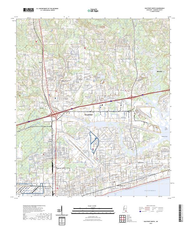
2024 Gulfport North
Harrison County, MS
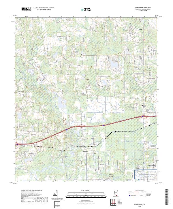
2024 Gulfport NW
Harrison County, MS
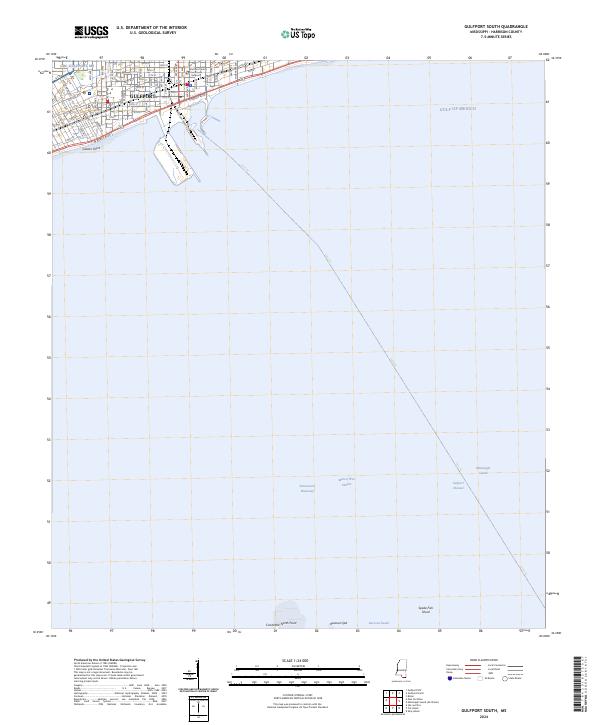
2024 Gulfport South
Harrison County, MS
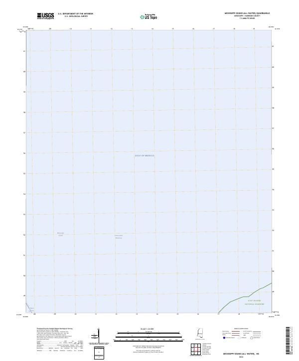
2024 Mississippi Sound (All Water)
Harrison County, MS
2024 Sellers
Harrison County, MS
2024 Ship Island
Harrison County, MS
2024 Success
Harrison County, MS
2024 White Plains
Harrison County, MS
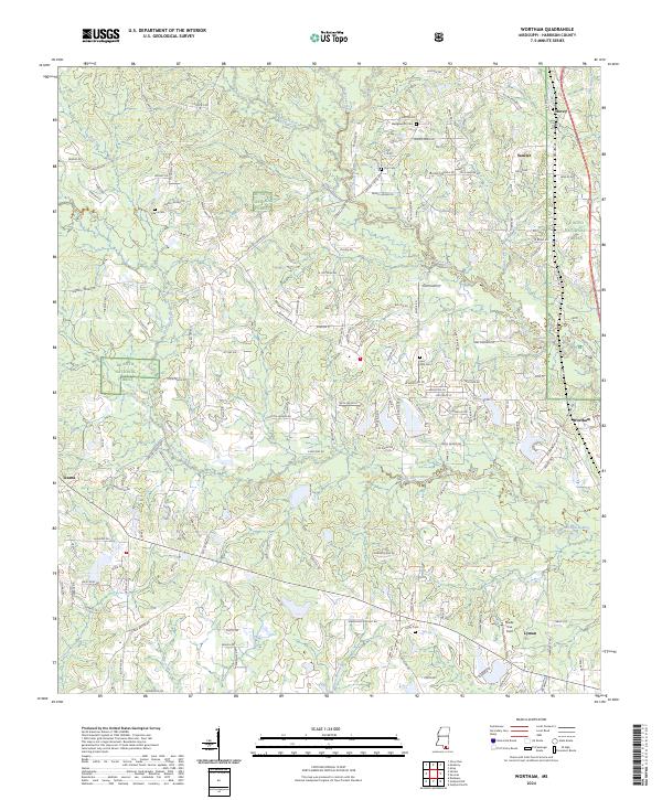
2024 Wortham
Harrison County, MS
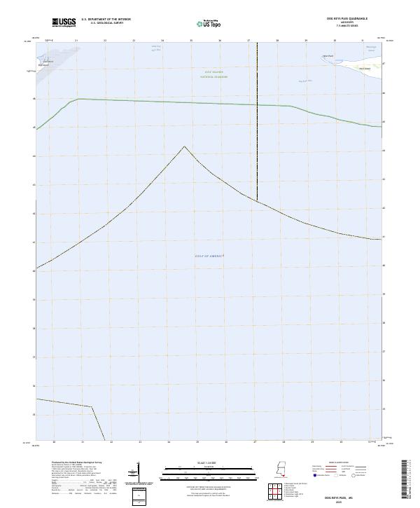
2025 Dog Keys Pass
Harrison County, MS
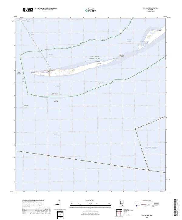
2025 Ship Island
Harrison County, MS