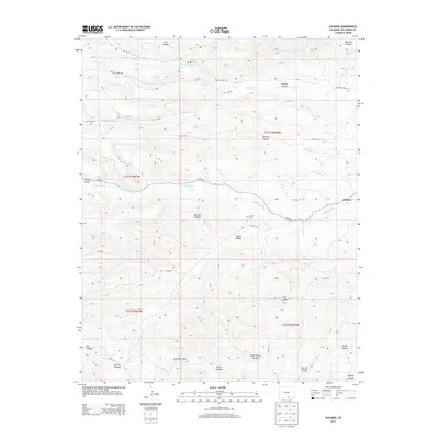
2013 Map of Gulnare
USGS Topo · Published 2013About this map
Gulnare serves as the primary settlement on this Las Animas County landscape, situated where the Apishapa River cuts through the canyon-carved terrain. This 2013 survey illustrates a region defined by complex drainage systems, featuring the convergence of N Fork Trujillo Cr, Middle Fork Trujillo Cr, and S Fork Trujillo Cr which form the main Trujillo Cr. The distribution of local landmarks, such as the Jarosa Cem in Jarosa Canyon, provides specific points of interest for those researching local family history or the early placement of rural Colorado cemeteries.
Find a feature on this map
38 named features on this map. Tap any name to fly to it.
Don’t see what you’re looking for? This feature index may not catch every label — zoom into the map to look around manually.
Map Details
Editions of this 2013 Gulnare Map
This is the sole edition of this map. No revisions or reprints were ever made.
Other maps of this area

1891 · Spanish Peaks
USGS Topo · 1:125,000

1893 · Spanish Peaks
USGS Topo · 1:125,000

1895 · Spanish Peaks
USGS Topo · 1:125,000

1897 · Spanish Peaks
USGS Topo · 1:125,000

1900 · Spanish Peaks
USGS Topo · 1:125,000

1951 · Madrid
USGS Topo · 1:24,000

1954 · Trinidad
USGS Topo · 1:250,000

1955 · Trinidad
USGS Topo · 1:250,000

1958 · Trinidad
USGS Topo · 1:250,000

1959 · Trinidad
USGS Topo · 1:250,000