
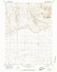
1963 Map of Gurney Peak
USGS Topo · Published 1967About this map
Gurney Peak dominates the northwestern highlands of Laramie County, marking a landscape defined by the drainage systems of West Kellehan Creek and East Kellehan Creek. The topography transitions from these prominent elevations down toward the plains, where water management is evident through the presence of the Petsch Reservoir and its associated Petsch Ditch. These man-made features illustrate the early efforts to redirect water across the arid Wyoming terrain for agricultural or livestock use.
Find a feature on this map
14 named features on this map. Tap any name to fly to it.
Don’t see what you’re looking for? This feature index may not catch every label — zoom into the map to look around manually.
Map Details
Editions of this 1963 Gurney Peak Map
This is the sole edition of this map. No revisions or reprints were ever made.
Other maps of this area

1899 · Goshen Hole
USGS Topo · 1:125,000

1954 · Cheyenne
USGS Topo · 1:250,000

1958 · Cheyenne
USGS Topo · 1:250,000

1960 · Tremain
USGS Topo · 1:24,000

1960 · Petsch Reservoir
USGS Topo · 1:24,000

1960 · Meriden
USGS Topo · 1:24,000

1963 · Lindbergh
USGS Topo · 1:24,000

1963 · Midway SE
USGS Topo · 1:24,000
1963 · Round Top
USGS Topo · 1:24,000
1981 · Cheyenne
USGS Topo · 1:100,000