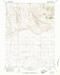
1963 Map of Round Top
USGS Topo · Published 1967About this map
Golden Prairie America Ch. stands as a central community landmark in this portion of eastern Laramie County during the early 1960s. The landscape is defined by the high plains topography of the High Plains, where the distinct elevations of Round Top and Hunter Flattop rise above the surrounding drainage basins. Water sources are critical in this arid ranching environment, with Bull Spring Creek and Herrick Creek providing the primary drainage, supplemented by several named springs and wells. The map reveals a high-altitude agricultural and grazing region organized by a strict section-line road grid, with subtle industrial activity indicated by a Gravel Pit. The detailed contour lines illustrate the transition between the flat prairie lands and the more complex terrain of the bluffs and mesas that characterize the Wyoming landscape.
Find a feature on this map
11 named features on this map. Tap any name to fly to it.
Don’t see what you’re looking for? This feature index may not catch every label — zoom into the map to look around manually.
Map Details
Editions of this 1963 Round Top Map
This is the sole edition of this map. No revisions or reprints were ever made.
Other maps of this area

1899 · Goshen Hole
USGS Topo · 1:125,000

1954 · Cheyenne
USGS Topo · 1:250,000

1958 · Cheyenne
USGS Topo · 1:250,000

1960 · Petsch Reservoir
USGS Topo · 1:24,000

1960 · Rocky Hollow
USGS Topo · 1:24,000

1960 · Meriden
USGS Topo · 1:24,000

1963 · Midway
USGS Topo · 1:24,000

1963 · Midway SE
USGS Topo · 1:24,000

1963 · Midway SW
USGS Topo · 1:24,000

1963 · Gurney Peak
USGS Topo · 1:24,000