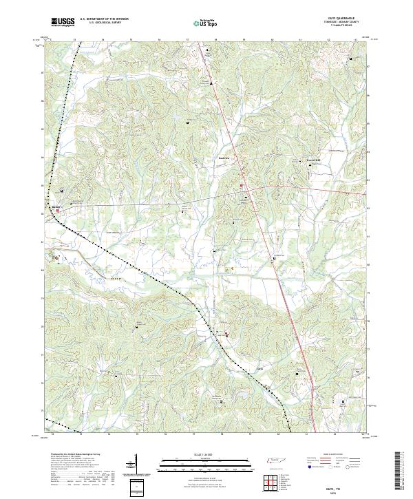
2022 Map of Guys
USGS Topo · Published 2022About this map
Muddy Creek and its various tributaries, including Little Muddy Cr and Brushy Br, define the hydrological character of this McNairy County landscape. The area is marked by a dense concentration of burial grounds, providing a significant resource for genealogical research. Distinctive sites like the Richardson Family Cem and Meeks Family Cem suggest deep-rooted family landholdings, while the Saint Rest Cem and Adams Chapel Cem anchor the rural communities.
Find a feature on this map
100 named features on this map. Tap any name to fly to it.
Don’t see what you’re looking for? This feature index may not catch every label — zoom into the map to look around manually.
Map Details
Editions of this 2022 Guys Map
This is the sole edition of this map. No revisions or reprints were ever made.
Other maps of this area

1936 · Kendrick
USGS Topo · 1:24,000

1936 · Purdy
USGS Topo · 1:24,000

1936 · Stantonville
USGS Topo · 1:24,000

1936 · Michie
USGS Topo · 1:24,000

1949 · Purdy
USGS Topo · 1:24,000

1949 · Stantonville
USGS Topo · 1:24,000

1949 · Michie
USGS Topo · 1:24,000

1950 · Corinth
USGS Topo · 1:62,500

1950 · Kendrick
USGS Topo · 1:24,000

1951 · Chewalla
USGS Topo · 1:24,000