
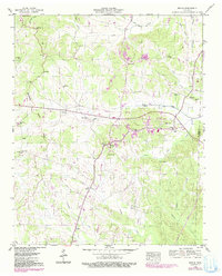
1949 Map of Michie
USGS Topo · Published 1974About this map
Michie serves as the central hub of this McNairy County landscape, situated near the Tennessee Valley Divide. The settlement pattern follows the local water systems, with Lick Creek and Owl Creek being significantly modified by the Lick Drainage Canal and Owl Drainage Canal, reflecting mid-century efforts to manage the wetlands for agricultural use. Several small rural communities and named crossroads such as Needmore, Caffey, and Tulu dot the terrain, often anchored by local landmarks like Sand Hill Ch or Lebanon Ch. Genealogists will find several family-named burial grounds, including Chambers Cem and Sanders Cem, as well as the Chambers school site. The map also records the expansion of local infrastructure through the Michie City Boundary and the introduction of industrial features like a Dragstrip and multiple Pipelines, showing the evolution of the area between the late 1940s and early 1970s.
Find a feature on this map
40 named features on this map. Tap any name to fly to it.
Don’t see what you’re looking for? This feature index may not catch every label — zoom into the map to look around manually.
Map Details
Editions of this 1949 Michie Map
2 editions found
Other maps of this area

1935 · Doskie
USGS Topo · 1:24,000

1936 · Counce
USGS Topo · 1:24,000

1936 · Kendrick
USGS Topo · 1:24,000

1936 · Pittsburg Landing
USGS Topo · 1:24,000

1936 · Purdy
USGS Topo · 1:24,000

1936 · Stantonville
USGS Topo · 1:24,000

1936 · Michie
USGS Topo · 1:24,000

1949 · Pittsburg Landing
USGS Topo · 1:24,000

1949 · Purdy
USGS Topo · 1:24,000

1949 · Stantonville
USGS Topo · 1:24,000