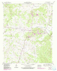
1949 Map of Michie
USGS Topo · Published 1991About this map
Michie serves as the central hub of this McNairy County landscape, situated where Tennessee 22 and Tennessee 57 converge. The topography is defined by the Tennessee Valley Divide, which separates the northern drainage of Owl Creek and Lick Creek from the southern reaches of Chambers Creek. This 1949 survey, with revisions noted through the late 1980s, captures a dense network of rural settlements and family landmarks including Pebble Hill, Needmore, and Tulu. Local history is preserved in the numerous community markers such as Sand Hill Ch, Sanders Cem, and Mt Olive Cem. The drainage patterns are intricate, featuring many named branches like Donald Branch and Wyatt Br that supported the agricultural life of the area during the mid-20th century.
Find a feature on this map
54 named features on this map. Tap any name to fly to it.
Don’t see what you’re looking for? This feature index may not catch every label — zoom into the map to look around manually.
Map Details
Editions of this 1949 Michie Map
2 editions found

Other maps of this area

1935 · Doskie
USGS Topo · 1:24,000

1936 · Counce
USGS Topo · 1:24,000

1936 · Kendrick
USGS Topo · 1:24,000

1936 · Pittsburg Landing
USGS Topo · 1:24,000

1936 · Purdy
USGS Topo · 1:24,000

1936 · Stantonville
USGS Topo · 1:24,000

1936 · Michie
USGS Topo · 1:24,000

1949 · Pittsburg Landing
USGS Topo · 1:24,000

1949 · Purdy
USGS Topo · 1:24,000

1949 · Stantonville
USGS Topo · 1:24,000