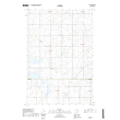
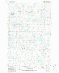
2018 Map of Guyson
USGS Topo · Published 2018About this map
The settlement of Guyson sits at the heart of this prairie landscape, where the flatlands of the Great Plains are marked by a dense network of seasonal wetlands and small lakes. Positioned along the southern edge of Logan County, the area is defined by a rigid grid of section-line roads ranging from 72nd St SE down to 80th St SE. Genealogists and local historians will find significant landmarks in the rural burial grounds of Tabor Congregation Cem and Lautt Cem, which serve as quiet markers of the early families who settled this portion of the Dakotas. The landscape is dominated by the township and range survey system, specifically covering parts of t133n r68w and surrounding townships. This 2018 survey illustrates the persistence of these small communities and the enduring agricultural structure along the Logan Co McIntosh Co border.
Find a feature on this map
19 named features on this map. Tap any name to fly to it.
Don’t see what you’re looking for? This feature index may not catch every label — zoom into the map to look around manually.
Map Details
Editions of this 2018 Guyson Map
This is the sole edition of this map. No revisions or reprints were ever made.
Other maps of this area

1953 · Jamestown
USGS Topo · 1:250,000

1956 · Jamestown
USGS Topo · 1:250,000
1982 · Coldwater Lake NW
USGS Topo · 1:24,000
1982 · Fredonia NW
USGS Topo · 1:24,000
1982 · Guyson
USGS Topo · 1:24,000
1982 · Coldwater Lake NE
USGS Topo · 1:24,000
1982 · Fredonia
USGS Topo · 1:24,000
1982 · Lehr NE
USGS Topo · 1:24,000
1982 · Ashley NE
USGS Topo · 1:24,000
1982 · Fredonia NE
USGS Topo · 1:24,000