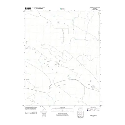
2010 Map of Gypsum Gap
USGS Topo · Published 2010About this map
The extractive industrial history of San Miguel County is etched across Big Gypsum Valley and Gypsum Valley, where dozens of named mining sites follow the geological contours of the land. In this 2010 landscape, operations like the Phillips 66 One Mine, Klondike Mine, and the evocative Cliff Dweller Mine dot the terrain surrounding Gypsum Gap. The map documents a dense concentration of small-scale mining prospects, including the Red Wing Mine and Jungle Basin Mine, suggesting a long period of prospecting and development in the high country. Drainage networks like West Fork Dry Creek and Dugout Wash cut through the arid basins, while solitary water sources such as Larson Spring provided essential relief in a territory dominated by mining claims and rugged backroads like r25 RD.
Find a feature on this map
48 named features on this map. Tap any name to fly to it.
Don’t see what you’re looking for? This feature index may not catch every label — zoom into the map to look around manually.
Map Details
Editions of this 2010 Gypsum Gap Map
This is the sole edition of this map. No revisions or reprints were ever made.
Other maps of this area

1916 · Paradox Valley
USGS Topo · 1:125,000

1922 · Paradox Valley
USGS Topo · 1:125,000

1948 · Bull Canyon
USGS Topo · 1:24,000

1948 · Hamm Canyon
USGS Topo · 1:24,000

1948 · Naturita NW
USGS Topo · 1:24,000

1948 · Gypsum Gap
USGS Topo · 1:24,000

1949 · Bull Canyon
USGS Topo · 1:24,000

1949 · Gypsum Gap
USGS Topo · 1:24,000

1949 · Naturita NW
USGS Topo · 1:24,000

1949 · Joe Davis Hill
USGS Topo · 1:24,000