
1948 Map of Naturita NW
USGS Topo · Published 1957About this map
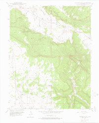
Paradox Valley dominates this 1948 topographic study, illustrating the dramatic geography of western Colorado at the boundary of Montrose and San Miguel Counties. The landscape is defined by the sharp rise of Monogram Mesa and the jagged profile of Sawtooth Ridge, creating a high-desert environment where water management was essential for any settlement or industry. The presence of the Thunderbolt Mine on the slopes of Monogram Mesa points to the region's mid-century mining activity, likely tied to the era's uranium or vanadium boom. Water resources are clustered in the southern portion of the quadrangle, including Spectacle Reservoir and the drainage network of Dry Creek and its West Fork. The transition from the flat valley floor to the surrounding mesas provides clear insight into the logistical challenges of resource extraction and ranching in this remote section of the Colorado Plateau.
Find a feature on this map
11 named features on this map. Tap any name to fly to it.
Don’t see what you’re looking for? This feature index may not catch every label — zoom into the map to look around manually.
Map Details
Editions of this 1948 Naturita NW Map
4 editions found
Other maps of this area

1916 · Paradox Valley
USGS Topo · 1:125,000

1922 · Paradox Valley
USGS Topo · 1:125,000

1948 · Bull Canyon
USGS Topo · 1:24,000

1948 · Uravan
USGS Topo · 1:24,000

1948 · Hamm Canyon
USGS Topo · 1:24,000

1948 · Gypsum Gap
USGS Topo · 1:24,000

1949 · Bull Canyon
USGS Topo · 1:24,000

1949 · Davis Mesa
USGS Topo · 1:24,000

1949 · Gypsum Gap
USGS Topo · 1:24,000

1949 · Uravan
USGS Topo · 1:24,000