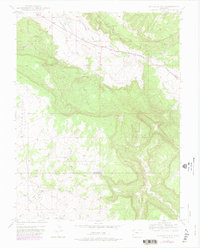
1948 Map of Naturita NW
USGS Topo · Published 1982About this map
Paradox Valley serves as the central focal point of this 1948 survey, where the low-lying agricultural and ranching basin is dramatically framed by the steep rising flanks of Monogram Mesa and Sawtooth Ridge. The landscape is a study in West Colorado's mining and water management history, featuring the Thunderbolt Mine perched above the valley floor. Water distribution in this arid environment is evidenced by the presence of Spectacle Reservoir and the drainage network of East Paradox Creek and Dry Creek. High-elevation grazing and livestock activity are noted at Corral No 2 and West Park, reflecting the era's reliance on open-range ranching across the rugged Montrose and San Miguel county line. The 1981 revisions add significant woodland detail to the original topography, showing the progression of land use in this uranium-rich region.
Find a feature on this map
14 named features on this map. Tap any name to fly to it.
Don’t see what you’re looking for? This feature index may not catch every label — zoom into the map to look around manually.
Map Details
Editions of this 1948 Naturita NW Map
4 editions found
Other maps of this area

1916 · Paradox Valley
USGS Topo · 1:125,000

1922 · Paradox Valley
USGS Topo · 1:125,000

1948 · Bull Canyon
USGS Topo · 1:24,000

1948 · Uravan
USGS Topo · 1:24,000

1948 · Hamm Canyon
USGS Topo · 1:24,000

1948 · Naturita NW
USGS Topo · 1:24,000

1948 · Gypsum Gap
USGS Topo · 1:24,000

1949 · Bull Canyon
USGS Topo · 1:24,000

1949 · Davis Mesa
USGS Topo · 1:24,000

1949 · Gypsum Gap
USGS Topo · 1:24,000