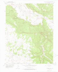
1948 Map of Naturita NW
USGS Topo · Published 1976About this map
The Paradox Valley floor and the surrounding high ground of Monogram Mesa dominate this 1948 survey of the Colorado backcountry. This landscape is defined by its industrial and ranching utility, featuring the Thunderbolt Mine tucked into the slopes and isolated improvements like Corral No 2. The drainage network is complex, with the East Paradox Creek and the intricate channels of the Dry Fork cutting through the terrain. A clear administrative boundary marks the division between Montrose and San Miguel Counties, bisecting the southern portion of the sheet. Transportation is represented by functional primitive routes including a designated Truck Route and the Monogram Road, reflecting the era's focus on resource extraction and livestock management. This map records the region's topographical character before modern development altered the remote drainages around Spectacle Reservoir.
Find a feature on this map
17 named features on this map. Tap any name to fly to it.
Don’t see what you’re looking for? This feature index may not catch every label — zoom into the map to look around manually.
Map Details
Editions of this 1948 Naturita NW Map
4 editions found
Other maps of this area

1916 · Paradox Valley
USGS Topo · 1:125,000

1922 · Paradox Valley
USGS Topo · 1:125,000

1948 · Bull Canyon
USGS Topo · 1:24,000

1948 · Uravan
USGS Topo · 1:24,000

1948 · Hamm Canyon
USGS Topo · 1:24,000

1948 · Naturita NW
USGS Topo · 1:24,000

1948 · Gypsum Gap
USGS Topo · 1:24,000

1949 · Bull Canyon
USGS Topo · 1:24,000

1949 · Davis Mesa
USGS Topo · 1:24,000

1949 · Gypsum Gap
USGS Topo · 1:24,000