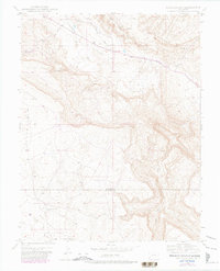
1948 Map of Naturita NW
USGS Topo · Published 1982About this map
Paradox Valley dominates this landscape, where the dramatic elevation change between the valley floor and Sawtooth Ridge highlights the region's complex geological structure. This 1948 survey, revised in the late 1970s, captures the industrial and natural character of the border between Montrose and San Miguel counties. The presence of the Thunderbolt Mine on the slopes of Monogram Mesa points to the area's history of uranium and vanadium exploration, which was a critical driver of local development during the mid-20th century. Transportation through this difficult terrain is facilitated by the Paradox Route and Long Park Road, while water management is evidenced by the Spectacle Reservoir tucked into the southern hills near Basin. The map also traces various drainage systems, including East Paradox Creek and the Dry Fork of the San Miguel River tributaries.
Find a feature on this map
16 named features on this map. Tap any name to fly to it.
Don’t see what you’re looking for? This feature index may not catch every label — zoom into the map to look around manually.
Map Details
Editions of this 1948 Naturita NW Map
4 editions found
Other maps of this area

1916 · Paradox Valley
USGS Topo · 1:125,000

1922 · Paradox Valley
USGS Topo · 1:125,000

1948 · Bull Canyon
USGS Topo · 1:24,000

1948 · Uravan
USGS Topo · 1:24,000

1948 · Hamm Canyon
USGS Topo · 1:24,000

1948 · Naturita NW
USGS Topo · 1:24,000

1948 · Gypsum Gap
USGS Topo · 1:24,000

1949 · Bull Canyon
USGS Topo · 1:24,000

1949 · Davis Mesa
USGS Topo · 1:24,000

1949 · Gypsum Gap
USGS Topo · 1:24,000