
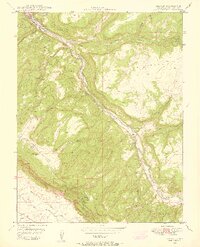
1948 Map of Uravan
USGS Topo · Published 1955About this map
Uranium and vanadium mining dominate this post-war landscape along the San Miguel River, where the Atomic Energy Commission collaborated on mapping the region's mineral-rich geology. The company town of Uravan sits at the confluence of the river and Hieroglyphic Canyon, serving as a focal point for the surrounding operations. The terrain is defined by dramatic mesas and deep canyons, including Long Mesa and Paradox Valley, which were heavily prospected during this era of atomic development.
Find a feature on this map
47 named features on this map. Tap any name to fly to it.
Don’t see what you’re looking for? This feature index may not catch every label — zoom into the map to look around manually.
Map Details
Editions of this 1948 Uravan Map
2 editions found
Other maps of this area

1916 · Paradox Valley
USGS Topo · 1:125,000

1922 · Paradox Valley
USGS Topo · 1:125,000

1948 · Bull Canyon
USGS Topo · 1:24,000

1948 · Naturita NW
USGS Topo · 1:24,000

1949 · Bull Canyon
USGS Topo · 1:24,000

1949 · Davis Mesa
USGS Topo · 1:24,000

1949 · Uravan
USGS Topo · 1:24,000

1949 · Naturita NW
USGS Topo · 1:24,000

1949 · Atkinson Creek
USGS Topo · 1:24,000

1949 · Red Canyon
USGS Topo · 1:24,000