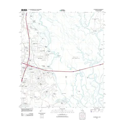
2012 Map of Haaswood
USGS Topo · Published 2012About this map
The Pearl River basin dominates this 2012 landscape, where the intricate hydrology of the Louisiana-Mississippi border creates a complex network of waterways like English Bayou, W Pearl River, and Cradock Slough. The residential expansion of Slidell is evident in the west, with numerous named subdivisions such as Magnolia Forest, Cross Gates, and Abney Country Air filling the space between Gum Bayou and the main river corridor. Genealogical interest is high in this quadrangle, as several burial sites including Rousseaux Cem and Harrison Cem are documented alongside old riverine points like Porters River Landing and Davis Landing. The eastern portion of the map is defined by the Pearl River State Wildlife Management Area and the edge of the John Stennis Space Center, illustrating the tension between protected wetlands, federal installations, and the growing suburban footprint of St. Tammany Parish.
Find a feature on this map
146 named features on this map. Tap any name to fly to it.
Don’t see what you’re looking for? This feature index may not catch every label — zoom into the map to look around manually.
Map Details
Editions of this 2012 Haaswood Map
This is the sole edition of this map. No revisions or reprints were ever made.
Other maps of this area

1892 · Chef Menteur
USGS Topo · 1:62,500

1893 · Rigolets
USGS Topo · 1:62,500

1914 · Nicholson
USGS Topo · 1:62,500

1921 · Nicholson
USGS Topo · 1:62,500

1935 · Slidell
USGS Topo · 1:62,500

1935 · English Lookout
USGS Topo · 1:31,680

1936 · North Shore
USGS Topo · 1:31,680

1936 · Chef Menteur
USGS Topo · 1:62,500

1936 · Rigolets
USGS Topo · 1:62,500

1939 · Slidell
USGS Topo · 1:62,500