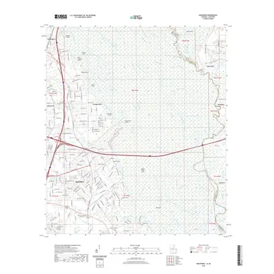
2020 Map of Haaswood
USGS Topo · Published 2020About this map
Slidell and the sprawling wetlands of the West Pearl River basin define this landscape at the Louisiana-Mississippi border. The river system dominates the eastern half of the sheet, where complex waterways like the West Middle River and Steamboat Bayou weave through Middle River Island and toward Fritchie Marsh. In the west, the suburban expansion of Slidell is visible along Gause Blvd and Lake Village Blvd, contrasting with the more isolated settlements of Gainesville and Napoleon across the state line. Genealogists will find a high concentration of local burial sites, including Oak Grove Cem, Napoleon Cem, and Rousseaux Cem. Notable landmarks such as Morgan Bluff and Devils Elbow offer insight into the topographical character of the river bends before they reach the Gulf coastal marshes.
Find a feature on this map
213 named features on this map. Tap any name to fly to it.
Don’t see what you’re looking for? This feature index may not catch every label — zoom into the map to look around manually.
Map Details
Editions of this 2020 Haaswood Map
This is the sole edition of this map. No revisions or reprints were ever made.
Other maps of this area

1892 · Chef Menteur
USGS Topo · 1:62,500

1893 · Rigolets
USGS Topo · 1:62,500

1914 · Nicholson
USGS Topo · 1:62,500

1921 · Nicholson
USGS Topo · 1:62,500

1935 · Slidell
USGS Topo · 1:62,500

1935 · English Lookout
USGS Topo · 1:31,680

1936 · North Shore
USGS Topo · 1:31,680

1936 · Chef Menteur
USGS Topo · 1:62,500

1936 · Rigolets
USGS Topo · 1:62,500

1939 · Slidell
USGS Topo · 1:62,500