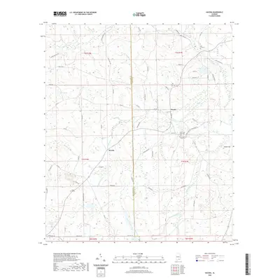
2020 Map of Hacoda
USGS Topo · Published 2020About this map
The settlement of Hacoda and the rural crossroads of Howells anchor this landscape along the border of Covington Co and Geneva Co. This region of southern Alabama is defined by its numerous small water bodies and wetlands, including the expansive Big Swamp and several named catchments like Pigeon Pond, Norris Pond, and Holley Pond. The drainage pattern is intricate, with Panther Cr, Flat Creek, and Eightmile Cr carving through the low-lying terrain near Buffalo Hill.
Find a feature on this map
76 named features on this map. Tap any name to fly to it.
Don’t see what you’re looking for? This feature index may not catch every label — zoom into the map to look around manually.
Map Details
Editions of this 2020 Hacoda Map
This is the sole edition of this map. No revisions or reprints were ever made.
Other maps of this area

1949 · Glendale
USGS Topo · 1:62,500

1949 · Laurel Hill
USGS Topo · 1:62,500

1950 · Laurel Hill
USGS Topo · 1:62,500

1951 · Glendale
USGS Topo · 1:62,500

1953 · Andalusia
USGS Topo · 1:250,000

1957 · Andalusia
USGS Topo · 1:250,000

1957 · Pensacola
USGS Topo · 1:250,000

1959 · Pensacola
USGS Topo · 1:250,000

1960 · Pensacola
USGS Topo · 1:250,000
1968 · Samson
USGS Topo · 1:24,000