
1951 Map of Hagerman
USGS Topo · Published 1953About this map
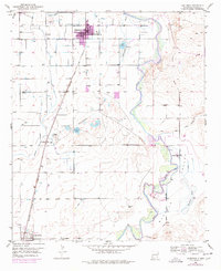
The Pecos River carves a winding path through this 1951 survey, defining the agricultural character of the Buffalo Valley in southeastern New Mexico. The town of Hagerman serves as a central hub, supported by the Atchison Topeka and Santa Fe railroad and the critical irrigation provided by the Hagerman Canal. This infrastructure transformed the arid landscape into a productive farming region, visible in the numerous ditches and landmarks like the Buffalo Valley Farm.
Find a feature on this map
21 named features on this map. Tap any name to fly to it.
Don’t see what you’re looking for? This feature index may not catch every label — zoom into the map to look around manually.
Map Details
Editions of this 1951 Hagerman Map
2 editions found
Other maps of this area

1950 · Dexter West
USGS Topo · 1:24,000

1950 · Dexter East
USGS Topo · 1:24,000

1951 · Ninemile Well
USGS Topo · 1:24,000

1951 · Diamond Mound
USGS Topo · 1:24,000

1952 · Bar C Bar Ranch
USGS Topo · 1:24,000

1952 · Hagerman SW
USGS Topo · 1:24,000

1953 · Espuela
USGS Topo · 1:24,000

1954 · Carlsbad
USGS Topo · 1:250,000

1955 · Artesia NE
USGS Topo · 1:24,000

1955 · Roswell
USGS Topo · 1:250,000