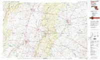
1983 Map of Hagerstown
USGS Topo · Published 1984About this map
Hagerstown and the surrounding tri-state borderlands of Maryland, Pennsylvania, and West Virginia appear here in high-relief detail, centered on the corrugated ridges of the Blue Ridge and South Mountain. This 1983 edition captures a region defined by its strategic corridors and military heritage, from the sprawling grounds of Gettysburg National Military Park to the secure perimeters of Letterkenny Army Depot and Fort Ritchie Military Reservation. The landscape is a complex network of valley settlements like Waynesboro and Chambersburg connected by the modern I-81 and I-70 thoroughfares.
Find a feature on this map
86 named features on this map. Tap any name to fly to it.
Don’t see what you’re looking for? This feature index may not catch every label — zoom into the map to look around manually.
Map Details
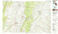
Editions of this 1983 Hagerstown Map
2 editions found
Other maps of this area

1884 · Harpers Ferry
USGS Topo · 1:125,000

1891 · Harpers Ferry
USGS Topo · 1:125,000

1892 · Ellicott
USGS Topo · 1:62,500

1893 · Frederick
USGS Topo · 1:125,000

1893 · Harpers Ferry
USGS Topo · 1:125,000

1894 · Ellicott
USGS Topo · 1:62,500

1894 · Frederick
USGS Topo · 1:125,000

1894 · Winchester
USGS Topo · 1:125,000

1899 · Hancock
USGS Topo · 1:62,500

1900 · Mercersburg
USGS Topo · 1:62,500