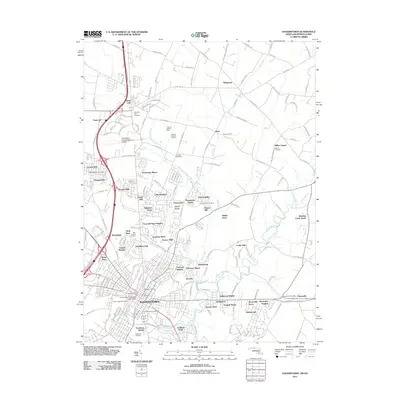
2011 Map of Hagerstown
USGS Topo · Published 2011About this map
Antietam Creek and its tributary Marsh Run drain the rolling countryside north of Hagerstown, where suburban expansion meets the longstanding agricultural roots of Washington County. This early 21st-century landscape is defined by its numerous residential developments, such as Northridge Manor, Paramount, and Fountain Head, which surround the historic core. The map highlights the area's deep genealogical importance through its many burial grounds, including the large Rose Hill Cemetery and the more remote Beautiful View Cemetery near the Maryland-Pennsylvania border.
Find a feature on this map
172 named features on this map. Tap any name to fly to it.
Don’t see what you’re looking for? This feature index may not catch every label — zoom into the map to look around manually.
Map Details
Editions of this 2011 Hagerstown Map
This is the sole edition of this map. No revisions or reprints were ever made.
Other maps of this area

1900 · Mercersburg
USGS Topo · 1:62,500

1902 · Chambersburg
USGS Topo · 1:62,500

1902 · Mercersburg
USGS Topo · 1:62,500

1909 · Hagerstown
USGS Topo · 1:48,000

1912 · Hagerstown
USGS Topo · 1:62,500

1912 · Williamsport
USGS Topo · 1:62,500

1942 · Hagerstown
USGS Topo · 1:125,000

1943 · Hagerstown
USGS Topo · 1:125,000

1943 · Chambersburg
USGS Topo · 1:62,500

1943 · Mercersburg
USGS Topo · 1:62,500