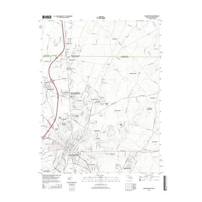
2014 Map of Hagerstown
USGS Topo · Published 2014About this map
Hagerstown and its northern suburbs are depicted at a peak of modern expansion, where the urban grid meets the agricultural heritage of the Cumberland Valley. The landscape is defined by the winding course of Antietam Creek and its tributaries, including Marsh Run and Hamilton Run, which once powered the region's early milling industry. Significant genealogical landmarks are concentrated in the city's historic core, such as Saint Marys Graveyard and Saint Johns Churchyard, while the expansion of the late 20th century is evident in the residential sprawl of Fountainhead-Orchard Hills and Colonial Park. Along the northern border, the Pennsylvania-Maryland line bisects rural communities like State Line and Wingerton. Infrastructure developments like the Hagerstown Regional Airport and the Hagerstown Community College underscore the area's role as a regional hub of transportation and education.
Find a feature on this map
250 named features on this map. Tap any name to fly to it.
Don’t see what you’re looking for? This feature index may not catch every label — zoom into the map to look around manually.
Map Details
Editions of this 2014 Hagerstown Map
This is the sole edition of this map. No revisions or reprints were ever made.
Other maps of this area

1900 · Mercersburg
USGS Topo · 1:62,500

1902 · Chambersburg
USGS Topo · 1:62,500

1902 · Mercersburg
USGS Topo · 1:62,500

1909 · Hagerstown
USGS Topo · 1:48,000

1912 · Hagerstown
USGS Topo · 1:62,500

1912 · Williamsport
USGS Topo · 1:62,500

1942 · Hagerstown
USGS Topo · 1:125,000

1943 · Hagerstown
USGS Topo · 1:125,000

1943 · Chambersburg
USGS Topo · 1:62,500

1943 · Mercersburg
USGS Topo · 1:62,500