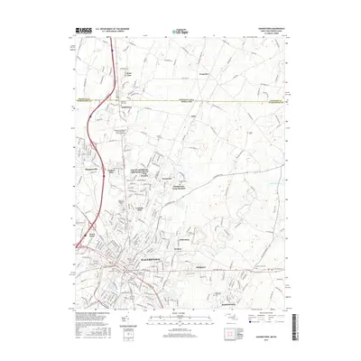
2016 Map of Hagerstown
USGS Topo · Published 2016About this map
Hagerstown serves as a dense hub of transport and history where the Maryland and Pennsylvania borders meet at the State Line. This 2016 survey documents the northern expansion of the city into communities like Fountainhead-Orchard Hills and Paramount-Long Meadow. The landscape is a mix of high-traffic infrastructure, such as the Hagerstown Regional Airport, and legacy sites including Saint Johns Churchyard and Saint Marys Graveyard.
Find a feature on this map
245 named features on this map. Tap any name to fly to it.
Don’t see what you’re looking for? This feature index may not catch every label — zoom into the map to look around manually.
Map Details
Editions of this 2016 Hagerstown Map
This is the sole edition of this map. No revisions or reprints were ever made.
Other maps of this area

1900 · Mercersburg
USGS Topo · 1:62,500

1902 · Chambersburg
USGS Topo · 1:62,500

1902 · Mercersburg
USGS Topo · 1:62,500

1909 · Hagerstown
USGS Topo · 1:48,000

1912 · Hagerstown
USGS Topo · 1:62,500

1912 · Williamsport
USGS Topo · 1:62,500

1942 · Hagerstown
USGS Topo · 1:125,000

1943 · Hagerstown
USGS Topo · 1:125,000

1943 · Chambersburg
USGS Topo · 1:62,500

1943 · Mercersburg
USGS Topo · 1:62,500