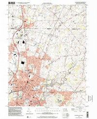
1999 Map of Hagerstown
USGS Topo · Published 2002About this map
The Mason and Dixon Line serves as a stark historical boundary at the northern edge of this landscape, separating Maryland from Pennsylvania. The city of Hagerstown dominates the southern portion of the sheet, revealing a dense urban grid that transitions into the suburban developments of Paramount and Longmeadow. This late-twentieth-century survey documents the city's infrastructure just before the turn of the millennium, anchored by the Courthouse and County Hospital downtown, and the Washington County Regional Airport to the northwest.
Find a feature on this map
66 named features on this map. Tap any name to fly to it.
Don’t see what you’re looking for? This feature index may not catch every label — zoom into the map to look around manually.
Map Details
Editions of this 1999 Hagerstown Map
This is the sole edition of this map. No revisions or reprints were ever made.
Other maps of this area

1900 · Mercersburg
USGS Topo · 1:62,500

1902 · Chambersburg
USGS Topo · 1:62,500

1902 · Mercersburg
USGS Topo · 1:62,500

1909 · Hagerstown
USGS Topo · 1:48,000

1912 · Hagerstown
USGS Topo · 1:62,500

1912 · Williamsport
USGS Topo · 1:62,500

1942 · Hagerstown
USGS Topo · 1:125,000

1943 · Hagerstown
USGS Topo · 1:125,000

1943 · Chambersburg
USGS Topo · 1:62,500

1943 · Mercersburg
USGS Topo · 1:62,500