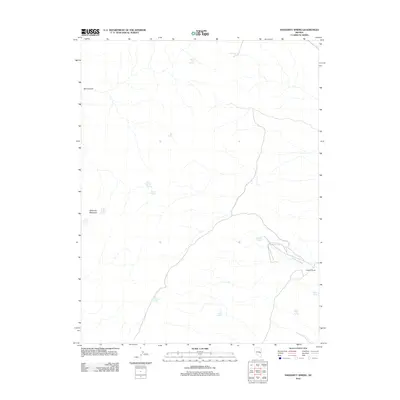
2012 Map of Haggerty Spring
USGS Topo · Published 2012About this map
Haggerty Ranch and its surrounding water sources define this high-desert landscape in Nye County, where life and transit are dictated by the presence of isolated springs. The terrain is marked by significant topographical landmarks such as Ninemile Mountain and the deep incision of Box Canyon. Water, though sparse, is meticulously documented through a network of named springs, including Cottonwood Spring, Stink Pot Spring, and the clustered Middle Parker Spring and West Parker Spring. The drainage patterns are clearly visible through Haggerty Wash, which serves as a primary geographic corridor in this arid region. This survey captures a moment in the early 21st century when these remote desert outposts and their vital water points remained the primary features of the local geography.
Find a feature on this map
16 named features on this map. Tap any name to fly to it.
Don’t see what you’re looking for? This feature index may not catch every label — zoom into the map to look around manually.
Map Details
Editions of this 2012 Haggerty Spring Map
This is the sole edition of this map. No revisions or reprints were ever made.
Other maps of this area

1956 · Lund
USGS Topo · 1:250,000

1960 · Lund
USGS Topo · 1:250,000

1969 · Shingle Pass
USGS Topo · 1:24,000

1969 · Moorman Spring SE
USGS Topo · 1:24,000

1969 · Parker Station
USGS Topo · 1:24,000

1969 · Shingle Pass SE
USGS Topo · 1:24,000

1969 · Moorman Spring NE
USGS Topo · 1:24,000

1969 · Haggerty Spring
USGS Topo · 1:24,000
1977 · Bullwhack Summit
USGS Topo · 1:24,000
1977 · Brown Knoll
USGS Topo · 1:24,000